|

Understanding through Discussion |
|
|
Register | Sign In |
|
QuickSearch
Summations Only | Thread ▼ Details |
|
Thread Info
|
|
|
| Author | Topic: Why the Flood Never Happened | |||||||||||||||||||||||||||||||||||||||||||||||||||
|
RAZD Member (Idle past 1432 days)  Posts: 20714 From: the other end of the sidewalk Joined:
|
I'm talking about long sections of the strata you can see in many views of the canyon from a distance where the horizontality of the layers is all intact, which I claim show the original condition of the layers when they were laid down; the interfaces between the layers are all straight and level, they are all identical as to form, all of this showing they were laid down by the same processes and not over millions of years of varied processes. There are some layers that appear intact at a great distance, but up close you see disturbances in the tops of the kind I have already mentioned. Some such layers show terrestrial type erosion on their surface layers.
Notice the jagged tops of layers 6,7 and 9 ... Sedimentary layers are sedimentary layers, Faith, and yes the process of sedimentation is the same for each layer. We see this in ocean sediments and lake sediments, and it is a stunning fact of physics that sedimentation in water environments produces level bottoms, and these layers build up, along with the growth of marine organisms and plants ... the evidence of which you can see when you look close up. If you are going to claim that these layers were formed suddenly in a matter of days then you need to explain how animal burrows and tunnels and plant roots can form in these layers as they are laid down. The time it takes for form a layer doesn't depend on great age, but the accumulation of several feet of sediment does and the formation of different types of layers does. Clay takes days to settle (15"/day), silt a little less, sand less still ... thus large boulders should be at the bottom followed by gravel, sand, silt and clay --- if they are undisturbed layers of deposition. Shale forms from clay and fine mud. You have a shale layer near the bottom of the (fairly) horizontal top (blue) layers ... in the middle of the Tonto Group, not at the top. You have several layers of sandstone above the shale and two layers of limestone in between sandstone layers ... Limestone - Wikipedia
quote: So you need two distinct complete die offs of the little critters here to make these layers ... If you mix these layers up -- and you need to because there are sandstones at the top ... and several other locations ... then you don't have an undisturbed deposition process. When you have the layers sorted into different kinds of layers then you have a problem with sudden deposition in a matter of days.
I'm talking about disturbances that would occur on the surface of the earth where a layer was supposedly exposed over a very long period of time. There would be erosion visible from across the canyon, not erosion you have to get up close to see. ... But you do see erosion from across the canyon -- what do you think made all those spires? what made all those side canyons that branch off the main canyon at large angles? What do you think is carving the bottom of the canyon now? What do you think cut through a lava flow that built up a dam in the river at one point? What do you think makes so many parts of the canyon walls and spires to be undercut? What do you think makes the grand panorama of spires and bluffs so dramatic? Can you tell me which of these pictures does not show erosion? grand canyon - Bing images Is this what you mean?
And how do you form that last picture with flood overflow? Just askin
... Tectonic disturbances would not have left a layer or stack of layers like that intact, ... Why not? There are many different patterns of earthquakes including horizontal shift, which would not disturb the alignment of layers. In fact there ARE some layers that are tilted on angles and then eroded ...
... and any layer that was laid down on top of it would not be neatly flat and straight at the connection with the buckled layer but would conform to its; ... Conform at the bottom, which every single layer in the grand canyon does, because that is the way slow sedimentary processes work ... and their top surfaces as they build up are level ...
... Animal burrows don't affect the structure of the layers which is what I'm talking about. But how do you get burrows from animals and insects that burrow into sand and earth ... how do you get those in solid rock that the animals and insects are not capable of burrowing into? How do you explain burrows of land organisms deep into rock laid down and covered during a flood event?
... you would see a layer buckled between other layers all over the canyon, ... ummm no, it doesn't work that way. If there is side pressure then you get a shift fault, a diagonal line, where one side lifts up along the other ... unless it is deep enough in the earth to melt the stone, at which point the stone changes (it's been baked afterall) to metamorphic rock. Metamorphic rock - Wikipedia Personally I think metamorphic rock alone disproves the flood deposition fantasy ...
quote: How did we get all that transformed rock type on the surface of the earth if they were deposited by the flood?
... and in fact tectonic upheavals only occurred after all the strata were in place. ... The disturbances that occurred to the canyon did distort and tilt the layers in the immediate area but AFTER they were all in place ... Yeah, its kind of hard to throw stuff around when you don't have stuff to throw around ...
... not at different periods in time. ... So rock was split and filled in with granite and then split and filled in again --- all at the same time? Fascinating.
... I've argued that the uplift of the entire canyon was caused by the volcanic disturbance beneath the canyon, which tilted the lowest strata beneath a mile deep stack of sediments already in place above, causing the wide band of erosion just above the Great Conformity, between it and the horizontal layer above. ... So this uplift process jumbled the bottom rocks but didn't disturb the upper rocks at all ... like when you have a layer of oil on top of boiling water it keeps the surface from being riled up with no layer of mixed oil and water pockets but a nice clean line ... 
... It was no doubt tectonic movement that brought about the underground volcano and contributed to the whole picture here. ... Other way around -- the rising magma (not volcano) from the earth core caused the uplift that has lifted this whole section while the river continued to cut through it. This is why the land level rises around the river as you go down the canyon.
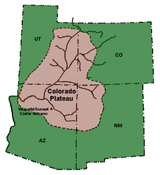
... . That upheaval uplifted the stack, ... Indeed, in a gradual process and over a very large area -- Colorado Plateau - Wikipedia
quote: Not just the area immediately around the canyon, which is at the south end of the plateau ... uplift over such a large area explains how the layers remain relatively horizontal.
... and you can see the strata in cross sections follow the contour of that uplift, showing they were all already in place. ... Indeed, it is so hard to move things before they are in place ...
... Some of the stack remained intact, all lifted up at once. ... It's not a stack of pancakes, Faith it is an area that covers thousands of miles in all directions, the Grand Canyon is only in a part of the uplifted area.
... At the very top, however, the strata would have cracked from the strain of the uplift stretching them over the mound. ... Except the "mound" was not that local -- it stretched thousands of miles and only lifted 1 mile at the highest point of the canyon ... a very very shallow slope.
... The cracks were then scoured out by inrushing Flood water ... The flood water rushed uphill? I don't follow ...
... carrying chunks of the uppermost strata (to the height of the current Grand Staircase at least) into the widening gap, eventually carving out the canyon. ... Where did those rocks end up? The bottom of the canyon empties out onto a plain of sedimentary landscape with a delta of gravel, no big chunks. Nor are there locations where chunks were lodged along the way, jumbled and tumbled at all angles ...
Not your little river but a huge cataract of water. And this is what it looks like when you have an actual huge cataract of water breaking through a berm ...
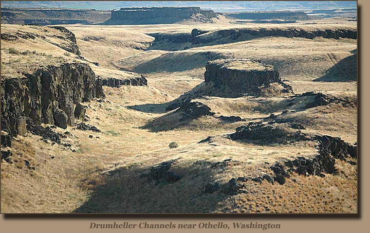
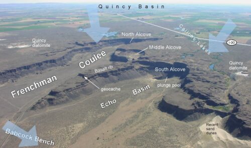
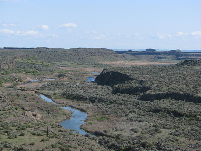
Thousands of miles of wide shallow channels with relatively flat bottoms and no spires, no V shaped channels. This is because the erosion occurs all at once, and scours the sides more than the bottom. The erosion pattern in the Grand Canyon is one that cuts into the bottom, not the sides, the sides are only affected when they become unstable and crack and fall into the bottom or when you have tributaries that flow to the canyon ... also with V shaped canyons. Enjoy. Edited by RAZD, : shale clay Edited by Admin, : Reduce minimum message width by reducing image width.by our ability to understand Rebel American Zen Deist ... to learn ... to think ... to live ... to laugh ... to share. Join the effort to solve medical problems, AIDS/HIV, Cancer and more with Team EvC! (click)
|
|||||||||||||||||||||||||||||||||||||||||||||||||||
|
subbie Member (Idle past 1282 days)  Posts: 3509 Joined:
|
You completely missed my point. I wasn't asking for an explanation of the iridium layer. I was pointing out that if there had been a world wide flood, there would be world wide evidence of it all at the same level all over the world. There isn't.
Ridicule is the only weapon which can be used against unintelligible propositions. -- Thomas Jefferson We see monsters where science shows us windmills. -- Phat It has always struck me as odd that fundies devote so much time and effort into trying to find a naturalistic explanation for their mythical flood, while looking for magical explanations for things that actually happened. -- Dr. Adequate Howling about evidence is a conversation stopper, and it never stops to think if the claim could possibly be true -- foreveryoung
|
|||||||||||||||||||||||||||||||||||||||||||||||||||
|
Percy Member  Posts: 22499 From: New Hampshire Joined: Member Rating: 4.9
|
Hi Faith,
You're forgetting your Grand Canyon scenario, which has the layers deposited during the height of the flood and then being eroded away before they lithified as the flood receded. How is it that layers at the top of the Grand Canyon, which were soft when you say the erosion occurred and had no layers above them to create pressure, are solidly lithified. Just as solidly lithified as those same layers miles away where they're buried under layers of sediment. Here's a good diagram illustrating the problem:
The Kaibab Limestone is the top layer at the Grand Canyon, but it is deeply buried at Bryce Canyon. How is it that it is just as firmly lithified in both places? This diagram also contradicts your belief that the layers are as flat as can be - obviously they're not flat over long distances (the diagram isn't to scale so the slope of the layers is exaggerated). The diagram also shows how layers can both bend and fault, which was another of your concerns, that there should be more faulting. On a scale of miles rock is very pliable, and when heated it is pliable on a scale of feet. --Percy
|
|||||||||||||||||||||||||||||||||||||||||||||||||||
|
petrophysics1 Inactive Member
|
Hi Faith,
So you have determined that all the sedimentary rocks in the world are the result of a worldwide flood. How did you do that? Suppose you and I go to somewhere in the Western U.S. where there are a lot of sedimentary rocks exposed. You have not read anything about this area. Please explain to me the procedure you follow to determine the depositional environment. You have stated the sedimentary rocks are the result of THE FLOOD, so you have determined the depositional environment. Therefore you must have a procedure to determine depositional environments. Tell me what it is. Then we can all compare what I do as a petroleum exploration geologist, which I will post after you answer, to what you do and have done. The readers can then decide which of us is a nut. P.S. I want to be clear. You are in the field in a place you have never been before, don't know the names of any formations or their ages. What is your procedure for figuring out their depositional environments and history. Please go through this step by step, so others know how to do this. P.P.S. Honest and ethical people admit when they don't know how to do something.
|
|||||||||||||||||||||||||||||||||||||||||||||||||||
|
Dr Adequate Member (Idle past 312 days)  Posts: 16113 Joined:
|
I find that absolutely laughable. Well, that settles it. When it comes to sedimentology, the decisive factor should always be the unsupported opinion of someone who needs to be shown photographs before she knows what a beach looks like.
|
|||||||||||||||||||||||||||||||||||||||||||||||||||
|
Percy Member Posts: 22499 From: New Hampshire Joined: Member Rating: 4.9
|
If all evidence contrary to your ideas is just evidence awaiting an explanation, your ideas can never be falsified.
Can we at least agree that the best theory is the one that places the least amount of evidence in the awaiting explanation category? --Percy
|
|||||||||||||||||||||||||||||||||||||||||||||||||||
|
Atheos canadensis Member (Idle past 3025 days)  Posts: 141 Joined:
|
So now you've gone from verbally trying to avoid addressing a the huge problem I have pointed out with your Flood fantasy to simply sending a jeer in my direction and scuttling away. I know I've pointed this out already, but you are really displaying a truly first-class level of hypocrisy. You say over and over that all of us should open our eyes and look at the evidence but you explicitly and repeatedly refuse to do the same yourself. I have pointed out that your fantasy requires a physical impossibility. The simple fact of the matter is that you know you can't weasel your way around that and so you have chosen to ignore it. Gotta love that christian virtue.
Edited by Atheos canadensis, : spelling
|
|||||||||||||||||||||||||||||||||||||||||||||||||||
Faith  Suspended Member (Idle past 1472 days)  Posts: 35298 From: Nevada, USA Joined: |
The original horizontality of the layers, which of course is easily determined if they are still horizontal, but is to be assumed even if they have been tilted or buckled; depending on the local situation the fact that completely different sediments are laid one upon another, which defies any slow normal-time explanation, the fact that the interface between the layers, which may be totally different sediments, most often shows a knife-edge close contact, no blurring between them, whatever small degree of erosion that may be seen there being explainable as runoff between the layers; and the fact that any distortion such as buckling or folding, explainable by tectonic or volcanic force, always affects a whole block of strata at once while the strata themselves remain parallel to each other, raising the question why the disturbance waited millions of years to occur (the individual strata always being explained in terms of such long time frames). Then if the contents of the individual layers are dug out, this usually shows a particular collection of fossils gathered within, which always suggests that they died en masse in a catastrophe that provided ideal conditions for fossilization rather than one by one in any normal scenario of life and death.
Edited by Faith, : No reason given. Edited by Faith, : No reason given. Edited by Faith, : No reason given. Edited by Faith, : No reason given.
|
|||||||||||||||||||||||||||||||||||||||||||||||||||
|
RAZD Member (Idle past 1432 days) Posts: 20714 From: the other end of the sidewalk Joined:
|
... different sediments are laid one upon another, which defies any slow normal-time explanation, ... No Faith, it defies rapid deposition. Rapid deposition doesn't give you time for individual layers, just one jumbled mess. For sorted layers you need a deposition, a pause, another deposition, another pause, etc etc
... the fact that the interface between the totally different sediments most often shows a knife-edge close contact, no blurring between them ... ... is evidence of a total break in the deposition process between the two layers, not a continuum of deposition.
blah blah enoughby our ability to understand Rebel American Zen Deist ... to learn ... to think ... to live ... to laugh ... to share. Join the effort to solve medical problems, AIDS/HIV, Cancer and more with Team EvC! (click)
|
|||||||||||||||||||||||||||||||||||||||||||||||||||
|
herebedragons Member (Idle past 885 days)  Posts: 1517 From: Michigan Joined:
|
Hi Faith ...
Take an ordinary mason jar, put 8 cm of soil in it, fill with water to about 3 cm from the rim, add a couple drops of detergent, put the lid on and shake until all the soil is suspended. Let sit for 1 hour (overnight for the organic matter to settle). What do you observe? Yes, the coarsest particles (coarse sand) settles out quickly, then fine sand, then silt and finally clay (the finest particles). Does this distribution resemble the Grand Canyon layers - coarse particles on bottom getting progressively finer towards the top? If not, then the Grand Canyon layers were not laid down in one single flood event. It's that simple - elementary school science project. Have you heard of Schrodinger's cat? Although his thought experiment was done for a bit of a different purpose, I think the basic idea applies here. So essentially how it works is this: If you put a live cat in a sealed box and close it up there is no way to know if the cat is at any moment dead or alive. Only when you open the box and observe the cat can you know for sure what the status of the cat is. So while the box is sealed there is an uncertainty as to what the cat's condition is - we just can't know for sure. However, when we open the box and the cat is alive we can assume the cat was alive while the box was sealed. When we repeat this over and over and every time we observe the cat alive, the case becomes stronger and stronger that the cat is alive while the box is sealed. This is what everyone here keeps telling you ... that every time we open the box the cat is alive. But your argument is still that we can't know for sure because we cannot directly observe it while it is sealed in the box. You suggest that maybe during that time it turned into a mouse or teleported to another dimension, etc... I think this is a pretty good analogy as to how you are arguing this issue. Think about it. No we can never be absolutely certain about what happened in the past, but every time we look it is OLD, OLD, OLD. ABE: Razd made a good point while I was preparing this post. In the sediment experiment I mentioned, do you see a knife edge between the layers? No, they are blurred and blend slightly one into the other. They are distinct layers, but not separated by a distinct edge. HBD Edited by herebedragons, : additional thoughtWhoever calls me ignorant shares my own opinion. Sorrowfully and tacitly I recognize my ignorance, when I consider how much I lack of what my mind in its craving for knowledge is sighing for. But until the end of the present exile has come and terminated this our imperfection by which "we know in part," I console myself with the consideration that this belongs to our common nature. - Francesco Petrarca "Nothing is easier than to persuade people who want to be persuaded and already believe." - another Petrarca gem.
|
|||||||||||||||||||||||||||||||||||||||||||||||||||
|
Faith Suspended Member (Idle past 1472 days) Posts: 35298 From: Nevada, USA Joined: |
Contrary to what you seem to expect, I love those cross sections of the Grand Canyon-Grand Staircase area and got a lot of my inspiration from them.
The Kaibab Limestone is the top layer at the Grand Canyon, but it is deeply buried at Bryce Canyon. How is it that it is just as firmly lithified in both places? It seems clear from that cross section itself that the layers that cover the Kaibab at the Grand Staircase also originally covered it at the Grand Canyon but were subsequently eroded away, I believe most likely when the volcanic disturbances which are usually illustrated on those cross sections by magma dikes and intrusions, but for some reason aren't in that diagram, uplifted the area into which the canyon is cut, and also the northernmost stack of the Grand Staircase. Tectonic movement is what probably triggered the volcanoes and added its own force to the breaking of the strata and the uplift and the distortion of the layers. My argument has been that the great weight of the rapidly accumulated strata is what promoted at least the initial hardening into rock, and the Kaibab seems to have been the point at which that hardening had proceeded enough for it to remain in place under the higher mile or so of strata that had compressed it, while those hgiher strata were cracked and broken up by the stretching caused by the uplift which was brought about by the volcanic and tectonic disturbance underneath the canyon.
This diagram also contradicts your belief that the layers are as flat as can be - obviously they're not flat over long distances (the diagram isn't to scale so the slope of the layers is exaggerated). This is why I asked that those particular view from within the GC where the horizontality and flatness are clearly preserved, be the subject under consideration, to demonstrate the lack of disturbance to the individual layers, which should contradict the idea that they were laid down individually over millions of years. But nobody wanted to do that and the cross sections actually demonstrate the same principle anyway as the layers are shown to be individually undisturbed, the distortions having occurred to the stack as a whole. I have no problem with these cross sections anyway which I've posted myself at my blog and possibly even here.
The diagram also shows how layers can both bend and fault, which was another of your concerns, that there should be more faulting. On a scale of miles rock is very pliable, and when heated it is pliable on a scale of feet. I've assumed the malleability which is shown in the distortion of strata in groups reflects the expectable condition of dampness right after the Flood, but it isn't crucial to my argument. The main argument is still that they distort, bend and fault AS A BLOCK, in this case as a block hundreds of miles long and a few miles deep, whereas if such disturbances had occurred to single layers anywhere along the line of their deposition, which according to OE theory took millions of years per layer, you would not have the appearance of neat parallel conformity of one layer to another you see in the diagram, you would see individually distorted layers that would lose their neat conformability to one another; you would see individually distorted contact lines between layers, and you would see irregular thicknesses over short lengths as deposition of new sediments would have had to fill in the irregularities of the lower disturbed layer. You would not have the neat parallel flatness in the view I wanted people to consider, OR the neat parallel regularity you see illustrated in the cross section you have provided, either one. I don't remember mentioning faulting, but perhaps I did, but the point would be that over millions of years on the OE model you would expect multiple volcanic events and much more faulting of layers that would show the disturbances to those individual layers I was just describing, rather than what is clearly illustrated in this diagram: which is clearly an effect to the entire stack as a whole, brought about by a couple of volcanic incidents that must have occurred in roughly the same time frame AFTER the entire stack was laid down over two miles deep. At the north end of the Grand Staircase some cross sections show that the strata north of where this diagram ends are tilted as a block at the fault line that has also pushed up the end that you see in the diagram. They also show a magma dike from the bottom of the strat to the top just south of the point where the diagram ends. The strata on the other side shown in other cross sections are quite a bit lower and tilt downward as a block away from the fault line, though they are identifiably the same strata in the same order as those in the Staircase. \ The conclusion is that one volcanic event caused one faulting event at that point that split the strata into two sections, ALL the strata at one and the same time. No volcanic or tectonic events occurred to any of the layers before the entire stack was in place. I could also describe the volcanic event under the Grand Canyon in the same terms but it takes too much time for now. I hope I've been clear; I do get rushed and misspeak at times.
|
|||||||||||||||||||||||||||||||||||||||||||||||||||
|
Faith Suspended Member (Idle past 1472 days) Posts: 35298 From: Nevada, USA Joined: |
Moving water creates layers in rapid deposition, and tides and long waves that wash across thousands of miles of land mass would give a fair amount of time between waves too.
Edited by Faith, : No reason given.
|
|||||||||||||||||||||||||||||||||||||||||||||||||||
|
Faith Suspended Member (Idle past 1472 days) Posts: 35298 From: Nevada, USA Joined: |
I don't assume the Flood created layers as your mason jar would, except perhaps here and there in some particular situations, but laid them down by currents and waves and tides over some period of time but certainly no millions of years. If knife edge contacts, which are visible in the actual strata, are a problem for deposition by moving water, which I don't think they are, they are a million times more of a problem for a slow deposition over millions of years.
Edited by Faith, : No reason given.
|
|||||||||||||||||||||||||||||||||||||||||||||||||||
|
Atheos canadensis Member (Idle past 3025 days) Posts: 141 Joined:
|
Moving water creates layers in rapid deposition, and tides and long waves that wash across thousands of miles of land mass would give a fair amount of time between waves too You keep saying this and it keeps making no sense. Perhaps you are simply not communicating effectively so try to be as clear as possible this time. Based on what you've said e.g.
During the Flood there would have been SHORT periods of exposure at the surface BETWEEN WAVES ...you believe that during the Flood there were huge waves that a) went down deep enough that the substrate was exposed at the base of them and b) had enough time between them to allow ephemerally-exposed sediments in which animals left tracks. Is that right? You think that there was ground exposed between waves during a flood that covered the tops of mountains? Two points about this. First, it makes absolutely no sense. How could a wave have exposed substrate before or behind it? This is not how waves work.Second, this is completely extra-biblical and in fact un-Biblical. You have made it clear that you think the Bible is the only way to know anything about the past, but here you are averring something (dry land during the Flood) that is definitely not in the Bible. And where exactly did the track-makers come from? You're claiming that in the middle of a global flood there were still animals that were paddling around, waiting for these fantastical waves to expose the substrate so they could walk around for a little while, then be engulfed again by the next wave.
|
|||||||||||||||||||||||||||||||||||||||||||||||||||
|
Dr Adequate Member (Idle past 312 days) Posts: 16113 Joined:
|
you would see individually distorted layers that would lose their neat conformability to one another; you would see individually distorted contact lines between layers, and you would see irregular thicknesses over short lengths as deposition of new sediments would have had to fill in the irregularities of the lower disturbed layer. This is exactly what we see.
|
|||||||||||||||||||||||||||||||||||||||||||||||||||
|
|
Do Nothing Button
Copyright 2001-2023 by EvC Forum, All Rights Reserved
![]() ™ Version 4.2
™ Version 4.2
Innovative software from Qwixotic © 2024