Interesting site - USGS topo maps interactive
http://store.usgs.gov/...OT&layout=6_1_61_48&uiarea=2%29/.do
You can also download maps.
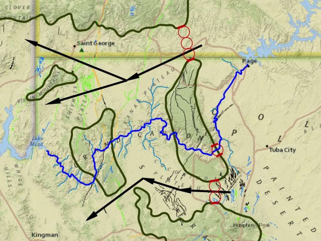
Northern Route
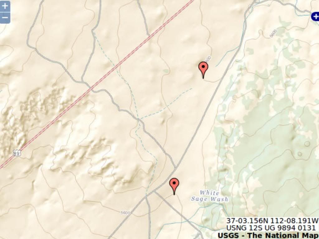
I captured this shot of where rte 89 crosses the ridge north of Grand Canyon:
The contours are at 40ft intervals and the two markers are on the 5600 ft contour with no other contour between them, so we know the highest point is less than 5640 ft.
The rims of the canyon are 7250 ft (south) and 7750 (north) ... and the high point of the Kaibab plateau is over 8400 ft ...
So the water would need to cut through (7250-5640 =) 1,610 ft of Kaibab Plateau before it gets to the elevation of the Rte 89 pass ...
A location that does not show any evidence of a water erosion channel across the ridge.
There's another pass a bit more north where another road crosses the Plateau, and its highest elevation is ~5800 ft and the width of water at the 7000 ft elevation is wider than the Grand Canyon ...
A location that does not show any evidence of a water erosion channel across the ridge.
That's a lot of water to just disappear or magically NOT flow downhill.
Southern Route
The highest elevation on the southern route shown is ~6460 ft, still ~800 ft below the canyon rim and this too would have a wide span of water at the 7000 ft elevation.
A location that does not show any evidence of a water erosion channel across the ridge.
Conclusion
Any flood flow that could have cut the canyon in its current location with the ridge intact would also have cut drainage channels in these locations. There is no evidence of drainage channels across these passes. There was no flood flow.
If flood flow carved the Grand Canyon then there should be at least two other canyons that would have been carved at the same time.
Enjoy.
Edited by RAZD, : .