|

Understanding through Discussion |
|
|
Register | Sign In |
|
QuickSearch
| Thread ▼ Details |
|
Thread Info
|
|
|
| Author | Topic: The TRVE history of the Flood... | |||||||||||||||||||||||||||||||||||||||
|
edge Member (Idle past 1728 days)  Posts: 4696 From: Colorado, USA Joined: |
Basins have NOTHING to do with the layers of the Cratonic Sequences.
Another bombastic statement from you. The cross sections clearly show that the cratonic sequences are thicker and the formations more numerous in the basins (by which I am including the ocean basins).
|
|||||||||||||||||||||||||||||||||||||||
|
edge Member (Idle past 1728 days) Posts: 4696 From: Colorado, USA Joined: |
I think that if you and Edge discuss his Michigan Basin diagram it will help explain how sediment layers form that are far thicker than the depth of water: ...
The intent was to show two things. 1. Evidence for subsidence.2. Thinning of the cratonic sequence over the continental crust. The latter is another concept that I'd like to introduce because Faith has complained the the water has to get exceptionally deep in order to deposit the cratonic sequences on higher parts of the craton; and therefor must have been due to the flood. My point is that, no, it doesn't need to be all that deep. My last diagram was to show how the crust (continental or oceanic) can sink into the asthenosphere during subsidence. I didn't expect such a agressively disagreeable reaction.
|
|||||||||||||||||||||||||||||||||||||||
Faith  Suspended Member (Idle past 1466 days)  Posts: 35298 From: Nevada, USA Joined: |
"Thicker and more numerous in the basins?" I'm sorry but I can't begin to fathom what this has to do with the problem I'm posing.
What do basins have to do with layers deposited flat all the way across the continent? What do basins in which all layers were already formed have to do with the problem of sea level rises required to cover each transgression's sedimentary deposits, ultimately to the point where it's had to rise as high as Noah's Flood would have? Or just about,(allowing for all that time assumed between the sequences). That is, the known geological column is a few miles thick. Whether it was laid down in "packages" by six separate transgressions of the sea, or one at a time, over hundreds of millions of years, the level of the sedimentary deposits would be rising with each deposition, so the water which deposited them also had to rise to cover it all. And that means it had to rise just about as high as Noah's Flood. Which makes this whole scenario good evidenced for that event. If you are saying something about deposition without water, where in the column did that occur? Edited by Faith, : No reason given.
|
|||||||||||||||||||||||||||||||||||||||
|
Faith Suspended Member (Idle past 1466 days) Posts: 35298 From: Nevada, USA Joined: |
1. Evidence for subsidence. Subsidence in a basin has absolutely nothing to do with the subsidence necessary to solve the problem of needing sea level to rise a couple of miles to lay down layers across the entire continent.
2. Thinning of the cratonic sequence over the continental crust. The latter is another concept that I'd like to introduce because Faith has complained the the water has to get exceptionally deep in order to deposit the cratonic sequences on higher parts of the craton; I haven't said anything about "higher parts of the craton," I'm talking about the entire geological column being laid down across the entire continent, which means both high and low areas.
and therefor must have been due to the flood. My point is that, no, it doesn't need to be all that deep. It would have to rise to the higher parts of the craton in the first place and then to the level of the sediments deposited on it, but again I haven't said anything about the craton itself. The layers of many of the sediments in the column span the continent and they span it miles deep. Doesn't matter where the craton is, to lay down sedimentary layers that deep means the sea had to rise to cover it all miles deep.
My last diagram was to show how the crust (continental or oceanic) can sink into the asthenosphere during subsidence. Which again has no relevance that I can see to what I'm talking about, unless there is evidence that the entire continental crust of North America sank into the asthenosphere by stages in tandem with the depth of each of the transgressive sequences.
I didn't expect such a agressively disagreeable reaction. OK, I'm sorry for the anger, but the incredible irrelevance of your response hit me as deceitful. Apparently it wasn't, so I'm sorry. But nevertheless it seems to be utterly irrelevant. (I guess it doesn't matter how much you insult me, right, if I insult you it's a major offense.) Edited by Faith, : No reason given. Edited by Faith, : \\\\\\\\\\
|
|||||||||||||||||||||||||||||||||||||||
|
jar Member (Idle past 416 days)  Posts: 34026 From: Texas!! Joined: |
Faith writes: Subsidence in a basin has absolutely nothing to do with the subsidence necessary to solve the problem of needing sea level to rise a couple of miles to lay down layers across the entire continent. Why do you post such utterly stupid comments Faith. New layers are being deposited across the entire continent every single day. The imaginary flood explains nothing.
|
|||||||||||||||||||||||||||||||||||||||
|
edge Member (Idle past 1728 days) Posts: 4696 From: Colorado, USA Joined:
|
"Thicker and more numerous in the basins?" I'm sorry but I can't begin to fathom what this has to do with the problem I'm posing.
Your assumptions are a case in point. What do basins have to do with layers deposited flat all the way across the continent? Clearly, the sediments are not uniform across the continent. These diagrams, based on oil exploration are pretty conclusive.
What do basins in which all layers were already formed ...
But they weren't already formed. The layers show the same transgressive sequence as the crattonic sequences.
... have to do with the problem of sea level rises required to cover each transgression's sedimentary deposits, ultimately to the point where it's had to rise as high as Noah's Flood would have?
They show that the layers thin and pinch out as higher levels of the craton are approached. Therefor sea level did not reach the deep-water proportions that you surmise.
That is, the known geological column is a few miles thick.
But they are not as thick over the craton. In fact, there is ample evidence that the sediments pinched out against an emergent land mass.
Whether it was laid down in "packages" by six separate transgressions of the sea, or one at a time, over hundreds of millions of years, the level of the sedimentary deposits would be rising with each deposition, so the water which deposited them also had to rise to cover it all.
Except for the simple fact that we know subsidence occurs. That is indisputable from the diagrams (and many more, if you want) that I presented. We also know that there is a mechanism for subsidence which includes loading by sediments.
And that means it had to rise just about as high as Noah's Flood. Which makes this whole scenario good evidenced for that event.
Except that there is not nearly the thickness on the craton, so the water was simply not that deep. And, in fact, there were shorelines preserved in those sediments which means that there was an emergent, actively eroding land mass.
If you are saying something about deposition without water, where in the column did that occur?
Well, for one it occurs in volcanic fields and sand ergs. But, wrt to the cratonic sequences they are irrelevant. I don't know where you came up with that.
|
|||||||||||||||||||||||||||||||||||||||
|
edge Member (Idle past 1728 days) Posts: 4696 From: Colorado, USA Joined: |
Why do you post such utterly stupid comments Faith. New layers are being deposited across the entire continent every single day.
In fact, without basin formation, the geological record would look very different and we wouldn't have an accurate understanding of sedimentation. Interestingly, prior to plate tectonic theory, the formation of huge, deep sedimentary basins was though to be an early phase of mountain building. It was the only explanation available. Maybe someone older than I (heh, heh ...) can remember those days.
|
|||||||||||||||||||||||||||||||||||||||
|
Adminnemooseus Administrator  Posts: 3974 Joined:
|
Why do you post such utterly stupid comments Faith. New layers are being deposited across the entire continent every single day. No real substance, just jerkishness. AdminnemooseusOr something like that.
|
|||||||||||||||||||||||||||||||||||||||
|
Faith Suspended Member (Idle past 1466 days) Posts: 35298 From: Nevada, USA Joined: |
Clearly, the sediments are not uniform across the continent. They don't have to be "uniform," just originally laid down flat, as Morris also said.
These diagrams, based on oil exploration are pretty conclusive. "Conclusive" about what?
But they weren't already formed. The layers show the same transgressive sequence as the crattonic sequences. I described why they were already formed. The basin formed after they were all in place. I'll review the evidence later. They SHOULD show the same transgressive sequences even in that case, though I don't know what shows that.
... have to do with the problem of sea level rises required to cover each transgression's sedimentary deposits, ultimately to the point where it's had to rise as high as Noah's Flood would have? They show that the layers thin and pinch out as higher levels of the craton are approached. Therefor sea level did not reach the deep-water proportions that you surmise. I gave a much better reason for the pinching out, but leaving that aside for the moment, why should the height of the craton have anything to do with how much water it would have taken to lay down the entire geological column across the continent? The regressing water would have caused the "unconformities" as Morris described, by eroding them away, so would also have eroded sediments on the higher craton. It should simply have erased the upper layers, not pinched them out. The thinning could have been the effect of deposition over the higher land, but could just as well be the effect of the sinking of the strata into the basin AFTER they were all laid down. Since the image is of a basin and not flat deposition over the craton. But again, there is nothing in what you've said to change what I described. Presumably the transgressions laid down the entire geological column to a depth of miles, because that is seen in many places, especially of course in the Grand Canyon, and that requires the rising of the sea level as I described. The presence of the craton has nothing to do with that.
Whether it was laid down in "packages" by six separate transgressions of the sea, or one at a time, over hundreds of millions of years, the level of the sedimentary deposits would be rising with each deposition, so the water which deposited them also had to rise to cover it all. Except for the simple fact that we know subsidence occurs. That is indisputable from the diagrams (and many more, if you want) that I presented. The transgressions would have to have surmounted the highest level of deposition laid down by the previous transgressions, and surmounted it by the depth of the current deposition to lay down the next thick "package." Your local basin subsidences are utterly inadequate and irrelevant to that requirement. You would need subsidence to the level of each transgression to keep the sea level that low. AS I'VE SAID a million times already.
We also know that there is a mechanism for subsidence which includes loading by sediments. Of course. I discussed that dozens of posts ago. But there is no evidence that the necessary extent of such a subsidence ever occurred. Your basins don't cut it.
And that means it had to rise just about as high as Noah's Flood. Which makes this whole scenario good evidenced for that event. Except that there is not nearly the thickness on the craton, so the water was simply not that deep. And, in fact, there were shorelines preserved in those sediments What is "THOSE" sediments? And of course there would be "shorelines" recording the different levels of the Flood water.
which means that there was an emergent, actively eroding land mass. What does "emergent" describe?: But actively eroding, yes, exactly what the Flood would have done as it receded. Your descriptions are not easy to follow but I haven't seen in anything you've said anything that changes what I've said. The height of the craton is irrelevant, subsidence in local basins is irrelevant. For the transgressions to have laid down the enormous depth of the geological column that actually exists, the sea level would have to have approached that of Noah's Flood. I argued all this in previous posts and I guess I'm going to have to go find them all. The unconformities would have been caused by the regression of each sequence, which would of course have been very rapid, not your slow millions of years affair, and the erosion probably removed a lot more than a layer or two. . Percy said you were talking about deposition of thick sediments without water, not I. So since you weren't, end of subject. Edited by Faith, : No reason given.
|
|||||||||||||||||||||||||||||||||||||||
|
New Cat's Eye Inactive Member |
They don't have to be "uniform," just originally laid down flat, as Morris also said. The reason they look flat today is because of the geological process of compaction. The environments that they represent (not are), could have been very different when they were on the surface and they were not necessarily flat when they were being laid down. Layers get a lot flatter over time as they build up, and it takes time.
quote:
|
|||||||||||||||||||||||||||||||||||||||
|
edge Member (Idle past 1728 days) Posts: 4696 From: Colorado, USA Joined:
|
What does "emergent" describe?: But actively eroding, yes, exactly what the Flood would have done as it receded.
The problem is that there was active erosion occurring throughout the deposition of all of the cratonic sequences. If you don't know what emergent means, I haven't the words to help you.
Your descriptions are not easy to follow but I haven't seen in anything you've said anything that changes what I've said.
Of course not. You are a YEC. And of course it's hard to follow. It's not as simple as YECs imagine.
The height of the craton is irrelevant, ...
In a way, this is correct. Mountain ranges are not necessarily considered part of the craton. However, it is clear that they existed and that the shed debris into the shallow cratonic seas.
... subsidence in local basins is irrelevant.
It is relevant to the degree that is shows how the sedimentary units vary across the continent. In other words, is shows how cratonic sequences vary in thickness. It shows the reasoning regarding 'shallow epeiric seas'.
For the transgressions to have laid down the enormous depth of the geological column that actually exists, the sea level would have to have approached that of Noah's Flood.
As I have pointed out repeatedly, the depth need not have been all that great. And more to the point, it need not have covered the higher parts of the continent composed of mountainous areas.
I argued all this in previous posts and I guess I'm going to have to go find them all. The unconformities would have been caused by the regression of each sequence, which would of course have been very rapid, not your slow millions of years affair, and the erosion probably removed a lot more than a layer or two.
Of course. The problem you have is that there are unconformities throughout the period of your flood.
Percy said you were talking about deposition of thick sediments without water, not I. So since you weren't, end of subject.
Almost certainly a misunderstanding on your part. I have reviewed the exchange and I see nothing to that effect.
I gave a much better reason for the pinching out, but leaving that aside for the moment, why should the height of the craton have anything to do with how much water it would have taken to lay down the entire geological column across the continent?
Ummm .... Because in a rising sea, it would take longer to cover higher areas?
The regressing water would have caused the "unconformities" as Morris described, by eroding them away, so would also have eroded sediments on the higher craton. It should simply have erased the upper layers, not pinched them out.
I never said that it did.
The thinning could have been the effect of deposition over the higher land, but could just as well be the effect of the sinking of the strata into the basin AFTER they were all laid down.
Well, exactly. The higher parts of the craton were not under water and receiving sediments for the same amount of time. The problem with your scenario is that each sedimentary unit is thicker in the basin, so it had to have been some effect that was present at the time of sedimentation, i.e. subsidence.
Since the image is of a basin and not flat deposition over the craton.
Don't know what you mean here. Of course the craton is on the side of the diagram.
But again, there is nothing in what you've said to change what I described. Presumably the transgressions laid down the entire geological column to a depth of miles, ...
But not everywhere.
... because that is seen in many places, especially of course in the Grand Canyon, and that requires the rising of the sea level as I described. The presence of the craton has nothing to do with that.
You realize that the GC sequence is part of a basin, do you not? Many of the formations do not exist across the continent, and if they do they thin to the east.
|
|||||||||||||||||||||||||||||||||||||||
|
edge Member (Idle past 1728 days) Posts: 4696 From: Colorado, USA Joined: |
The reason they look flat today is because of the geological process of compaction. The environments that they represent (not are), could have been very different when they were on the surface and they were not necessarily flat when they were being laid down.
Over short distances, the contacts can look quite 'flat'. However, in detail they are not flat and regionally they can thicken and thin and even disappear entirely. Layers get a lot flatter over time as they build up, and it takes time. For instance, in the Grand Canyon area, the Coconino sandstone varies from about 60 feet to over 600 and back to 60 going from east to west across the GC area. This can hardly be called 'flat'. There is no equivalent formation in Kansas, so we cannot consider it to be continental in scale. And yet, we see Faith say the same thing over and over again, that these sedimentary units are 'flat' with parallel top and bottom, and are continentally extensive. The point is that these deposits are quite thick at the margins of the cratons or in the interior basins, and thin across the craton if they even exist there.
|
|||||||||||||||||||||||||||||||||||||||
|
Minnemooseus Member  Posts: 3945 From: Duluth, Minnesota, U.S. (West end of Lake Superior) Joined: Member Rating: 10.0 |
For example, in this diagram:
4000 feet vertically is about the same as 40 miles horizontally (4000 feet vertically, ~200,000 feet horizontally). A vertical exaggeration of about x50 (if I did the math correctly). Without the vertical exaggeration the diagram would look something like:
In which you can't see anything, which is why vertical exaggeration is used. The strata are, in reality, still close to horizontal. Moose Edited by Minnemooseus, : Very minor tweak. Edited by Minnemooseus, : Source of graphics no longer exists, so put in Google cached version (poorer resolution).
|
|||||||||||||||||||||||||||||||||||||||
|
edge Member (Idle past 1728 days) Posts: 4696 From: Colorado, USA Joined: |
4000 feet vertically is about the same as 40 miles horizontally (4000 feet vertically, ~200,000 feet horizontally). A vertical exaggeration of about x50 (if I did the math correctly). Without the vertical exaggeration the diagram would look something like: In which you can't see anything, which is why vertical exaggeration is used. The strata are, in reality, still close to horizontal. Moose Heh,heh ... Yes. The layers appear to be 'flat', even perhaps, in the sense that Faith writes. However, the point is that the cumulative layers are thicker in the center of the basin and some of them do not exist at the margins. So, if you were budgeting to drill an oil field in the Ordovician, you'd better plan accordingly. Vertical exaggeration accentuates this observation. But it does have its disadvantages too. Edited by Adminnemooseus, : {Note - ... - Adminnemooseus} Edited by edge, : No reason given. Edited by Adminnemooseus, : Edge fixed his error, which eliminated the need for my previous edit material, which I have now removed.
|
|||||||||||||||||||||||||||||||||||||||
|
Faith Suspended Member (Idle past 1466 days) Posts: 35298 From: Nevada, USA Joined: |
We are in one of those phases where nothing you say makes any sense to me and you blame that on my being a YEC and that's really the end of the possibility of discussion.
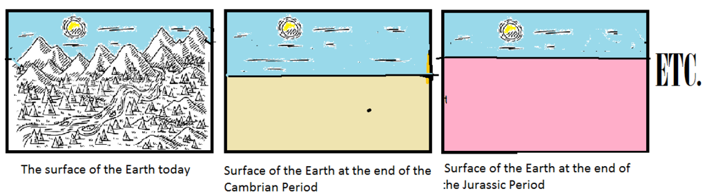
Again I don't see anything in your post that shows why the water didn't need to rise miles to lay down the sediments miles deep. You assert it but don't prove it or even give a half-baked reason for it. As long as the geological column exists miles deep anywhere on the continent it could only have been deposited by water miles deep. The Grand Canyon for a visible instance is a mile deep; adding the strata of the Grand Staircase shows the whole column was originally two miles deep at least, and there is reason to believe there were more strata above that. Nothing you have said about basins or the craton changes this picture. As John Morris said in that article about the St. Peter Sandstone, that sandstone reaches across the entire continent of North America 3000 miles by 1000 miles and up to 300 feet thick. That's evidence for the Flood. There were no mountains at that time, the continent was a flat featureless plain (scoured off by the forty days and nights of rain and subsequent mudslides etc.). The Cratonic sequences would have been phases of the Flood, each laying down a thousand or more feet of strata (1250 feet in the Sauk Sequence), the unconformities that mark each phase being the effect of the erosion caused by the regressive phase (not a "missing" time period millions of years old).
Basins would not have been there originally. The Michigan Basin is formed over a salt bed and that is often the cause of the subsidence of a stack of layers. The fact that the Cratonic Sequences are recognizable in the basins just means the unconformities that mark them are recognizable. The reasonable explanation for the whole thing is that the strata were laid across the whole continent one on top of another most likely by a rising tide, then much of it was eroded away when the tide went out. The water was rising all the time in the Flood. The next tide/ transgression was higher and deposited another deep thickness of strata on top of the first, then regressed, eroding away much of what it had just deposited, and so on up through the six sequences. The water had to keep rising to deposit at the higher and higher levels laid down by the previous tide. (Neither craton nor basins, had they existed, would have affected this basic pattern). After it was all laid down the basins formed, in the case of the Michigan because of the salt layer at the bottom of it. The eroded areas called unconformities remain visible in the basin. What the craton has to do with any of this completely escapes me. And there were no mountains during the Flood. The mountains rose afterward due to the tectonic pressure from the splitting apart of the continents. No, I don't believe Pangaea broke up during the Phanerozoic Eon, it broke up after the Flood and probably because of forces loosed by the Flood. There is good evidence of this timing in William Smith's cross section of the UK which shows ALL the strata neatly tilted as a block, all of them, the entire Phanerozoic column, not part of them. All were laid down by the Flood before the continent split (The St Peter Sandstone is seen in the UK and Europe too), and the whole stack was tilted when the continent split. (I believe there is good reason to explain the Great Unconformity that spans the continent as occurring after the Flood too; and a great deal of volcanic activity started at the same time. There is evidence in the GC for this timing -- MOST volcanoes did not occur during the laying down of the strata either, but only after it was all in place. All this is evident on the cross section of the GC area. (I think the splitting of the continents involved a lot of volcanic activity in the rift, where now the Atlantic Ridge is for instance.) The whole picture adds up to the Flood. The Cratonic Sequences add an interesting explanation for HOW the Flood happened. While there are lots of details that could be filled in, I really think this is case closed: The Flood Did It. ===========Previous posts from this thread on aspects of the discussion: Message 477 where I first raised the problem of the depth of the water needed to cover all the strata by the end of the Cratonic Sequences.
Message 514 where I deal with the question of subsidence as making such a high rise in sea level unnecessary.
Message 534 A Review
Edited by Faith, : No reason given. Edited by Faith, : No reason given. Edited by Faith, : No reason given. Edited by Faith, : No reason given. Edited by Faith, : No reason given.
|
|||||||||||||||||||||||||||||||||||||||
|
|
Do Nothing Button
Copyright 2001-2023 by EvC Forum, All Rights Reserved
![]() ™ Version 4.2
™ Version 4.2
Innovative software from Qwixotic © 2024