|

Understanding through Discussion |
|
|
Register | Sign In |
|
QuickSearch
| Thread ▼ Details |
|
Thread Info
|
|
|
| Author | Topic: fossil data superimposed on a map of pangea | ||||||||||||||||||||||||
|
eclectic1993 Junior Member (Idle past 4200 days) Posts: 9 Joined: |
Hi,
I'm interested in seeing a comprehensive record of fossils superimposed on a map of the super continent. I've seen such records on maps of our current earth topography. It would be nice to toggle various fossil groups. I think it would be of interest to yec and toe proponents. Also moving tectonic plates and showing fossils would be interesting. I am a programmer and have thought of creating such a project. It would be nice to see it done already. Regards,Chuck
|
||||||||||||||||||||||||
|
Admin Director  Posts: 13038 From: EvC Forum Joined: Member Rating: 2.1 |
Thread copied here from the fossil data superimposed on a map of pangea thread in the Proposed New Topics forum.
|
||||||||||||||||||||||||
|
Dogmafood Member (Idle past 376 days)  Posts: 1815 From: Ontario Canada Joined: |
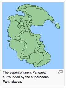
|
||||||||||||||||||||||||
|
Dr Adequate Member (Idle past 312 days)  Posts: 16113 Joined: |
Eclectic said "comprehensive".
|
||||||||||||||||||||||||
|
Dr Adequate Member (Idle past 312 days) Posts: 16113 Joined: |
I'm interested in seeing a comprehensive record of fossils superimposed on a map of the super continent. I've seen such records on maps of our current earth topography. Could you link us to such a map so that I can see how it was done? I'm finding it hard to visualize how this could be done well.
|
||||||||||||||||||||||||
|
eclectic1993 Junior Member (Idle past 4200 days) Posts: 9 Joined: |
Hi,
The map above is a generalized idea. If you go to Google and type 'maps of fossils', and then click on Images you'll see lots of examples. Most of the maps are localized to a state, a park, etc. Dogmafood posted a map showing a supercontinent. Imagine that map had dots corresponding to current latitude/longitude position of fossil discoveries. Further imagine an algorithm that converted current lat/long to pangea lat/long. It would be awesome to select a particular fossil type and see those occurences. So, do any of you know of such a program? Site? Project? You may be wondering why? I'm a creationist by faith. As is well known on this site I believe God created a super land mass, and all the critters we've come to love through our study of Paleontology. And that they existed together within the same time span. Yep! I sure do! Since fossil discoveries within the geological column world-wide are acceptable scientific data then I would like to see where the 'dots' fall and if there are any observable patterns that might lead me to reconsider what I believe. Thanks for your time. Regards,Chuck
|
||||||||||||||||||||||||
|
Dr Adequate Member (Idle past 312 days) Posts: 16113 Joined: |
There are an awful lot of fossils, you know. I seem to remember a figure of 250,000 known fossil species. The number of specimens would, of course, be much larger.
|
||||||||||||||||||||||||
|
herebedragons Member (Idle past 885 days)  Posts: 1517 From: Michigan Joined: |
I'm interested in seeing a comprehensive record of fossils superimposed on a map of the super continent. I would love to see something like this myself! It really wouldn't be all that hard to do. (at least it doesn't seem like it would be, but then I'm not a programmer  ) ) Plate tectonic animations do exist. Here's one (rather small though)
http://www.ucmp.berkeley.edu/geology/anim1.html There is an excellent source for fossil locations
http://paleodb.org/cgi-bin/bridge.pl?a=beginTaxonInfo You can search by scientific name and then get information about where the fossil was found, in what layer, etc... Dr. A is right, there are hundreds of thousands of occurrences. But you wouldn't have to do everyone of them. You could start with a single group. I was thinking of doing something like this with the Cetacea. Let me know what if you can come up with something. HBDWhoever calls me ignorant shares my own opinion. Sorrowfully and tacitly I recognize my ignorance, when I consider how much I lack of what my mind in its craving for knowledge is sighing for. But until the end of the present exile has come and terminated this our imperfection by which "we know in part," I console myself with the consideration that this belongs to our common nature. - Francesco Petrarca "Nothing is easier than to persuade people who want to be persuaded and already believe." - another Petrarca gem.
|
||||||||||||||||||||||||
|
Dr Adequate Member (Idle past 312 days) Posts: 16113 Joined: |
And that they existed together within the same time span. Making a map on that basis, however, would vitiate its usefulness. Perhaps you could have an option for creationists to turn these facts off --- or perhaps they could just flip the little switch in their head which allows them to ignore them, as usual.
|
||||||||||||||||||||||||
|
eclectic1993 Junior Member (Idle past 4200 days) Posts: 9 Joined: |
Hi,
@HBD,I've seen those tectonic plate animations. I've given some thought to converting present data latitude/longitude to tectonic plate coordinates. The 'time' factor could be controlled by selecting the year or the name corresponding to the geological timescale. Another feature is defining the starting point on a spherical surface along with an orientation of Pangea. This would allow Pangea to be moved about in an effort to align various fossil patterns up with migration, tropical zones, etc. I suppose pole reversals might be mapped on this time scale to assist in determining the best path of continental movement. As a programmer, databases of a 250,000 isn't too bad. Thanks for that link. I'll dig into it after dinner tonight. @DrAdequate,
quote:I don't know you well enough to know if you're just a playful person or can't help taking jabs where you can. 'Jabs' are why I avoided pro-creation and pro-evolution forums in the past. I guess time will tell. Thanks guys,Chuck
|
||||||||||||||||||||||||
|
Dr Adequate Member (Idle past 312 days) Posts: 16113 Joined: |
I don't know you well enough to know if you're just a playful person or can't help taking jabs where you can. Both. Mostly playful. "There was a star danced, and under that was I born."
'Jabs' are why I avoided pro-creation and pro-evolution forums in the past. I guess time will tell. Well, I hope you'll stick around, 'cos you seem like a nice person. My "jabs" aside, I was trying to make a serious point. If you go ahead with your map project, then the geological periods and the more precise dates to which geologists assign the fossils are important to a lot of people, such as geologists and paleontologists. If you leave these data off your map just 'cos you don't agree with them, then this will leave your map less useful than you would hope.
|
||||||||||||||||||||||||
|
Blue Jay Member (Idle past 2725 days)  Posts: 2843 From: You couldn't pronounce it with your mouthparts Joined: |
Hi, Eclectic.
I don't have a map for you, I'm afraid. I would be very interested in seeing a computer programmer put together a visual program for this, though. I'm sure you've heard of this before, but there's a whole branch of biology called biogeography that's specifically about trying to understand patterns of animal distributions and correlating these patterns with evolutionary patterns. For example, if you look at Eocene and Miocene rocks in South America, you see fossils of giant sloths, giant armadillos, terror birds and saber-toothed "marsupials." If you look at Eocene and Miocene rocks in North America, you see things like camels, deer, horses, elephants and saber-toothed cats. Then, if you look at Pliocene rocks, you start to see some giant sloths in North America, and you see some camels, deer, horses, elephants and saber-toothed cats in South America. The terror birds and saber-toothed "marsupials" disappear. Because of this observation, we conclude that North and South America must have been separated until the Pliocene. Then, in the Pliocene, the Isthmus of Panama formed, allowing animals to move between the continents. This is referred to as the Great American Interchange. Interestingly, if you look at marine life on either side of the Isthmus of Panama (e.g., Alpheus shrimp), you see pairs of closely-related species separated by the isthmus. This suggests that these species used to live through the entire area, but each species was split into two isolated populations when the isthmus formed (a Pacific population and a Caribbean population), and these isolated populations evolved into separate species. (see page 2 of this lecture). I know many other examples just like this. I would be very interested in seeing if you could put a large number of them together to create an animated visual aid that showcases the patterns of fossil occurrence. It would also be very informative for the evolution/creation debate. I hope my comments helped.-Bluejay (a.k.a. Mantis, Thylacosmilus) Darwin loves you.
|
||||||||||||||||||||||||
|
eclectic1993 Junior Member (Idle past 4200 days) Posts: 9 Joined: |
@Dr A.
quote:Alright! I'll stick around. It's disingenuous to leave out data. I don't like it when watching the news outlets nor do I like it in science. Scientists are constantly dealing with this ethical issue related to fabricating/tweaking/ignoring data that might result in a different conclusion. I read that only 5% of scientists hold to the creationist view point. I suppose that means that 19 evolutionists falsify results for every 1 creationist falsifying results. =) @Blue Jay,No, I did not know of the field called biogeography. Thanks. I've opened the Wikipedia page on the topic. quote:I spent some time yesterday thinking about the algorithm to move GPS coordinates back in time and on a round earth. My brain began to hurt as I started working out coordinate frame translations/rotations over the earth. So, now I'm thinking about a 2D map of the world as a good starting point. I think it would suffice until someone smarter came along. Although, I have created a sphere in DirectX and OpenGL for a 3D simulation. I need to think some more on this. So, it's conceivable to have a...* 2D/3D map of the world * Move the continents about from Pangea to current layout * Pin actual coordinates on the map (current layout) of actual fossil locations. * Move the maps about the world, with the pinned locations traveling with them. * toggle the geological time frame and/or show specific fossil types (family/genus/species) Let me think about this. Thanks,Chuck
|
||||||||||||||||||||||||
|
Dr Adequate Member (Idle past 312 days) Posts: 16113 Joined: |
It's disingenuous to leave out data. Well, as a YEC it would not actually be disingenuous of you to leave out data that you don't think are data. But it would make your map fairly useless to the people who think they are data. For me, the map would be most useful if I could flip through it by time and see what was present in the Jurassic, and what was there in the Cretaceous, and so forth. If you take out the element of time 'cos of your religious beliefs, then it will be a lot less useful to 99% of the people who would otherwise be interested in it.
I spent some time yesterday thinking about the algorithm to move GPS coordinates back in time and on a round earth. My brain began to hurt as I started working out coordinate frame translations/rotations over the earth. So, now I'm thinking about a 2D map of the world as a good starting point. I think it would suffice until someone smarter came along. You should definitely start with a spherical map, and translate it to 2D. It'll be easier in the long run. Now, the math has been done. There's this thing called Euler's fixed point theorem which tells you how to represent rigid motions on the surface of a sphere. One of the big breakthroughs in the development of plate tectonics was when a geologist finally found out about this bit of math and used a computer to apply it to plate motions. But if you tried to use a 2D map as your basic data, then you'd want a formula that would describe plate motions while also taking into account the deformations caused by mapping a sphere onto a plane all at once. It will be much simpler for you to apply one formula describing plate motions on a sphere, and a second formula to map the sphere onto a plane. The first bit is quite easy, and the second bit is so easy that you could in an afternoon provide the users with a choice of their favorite map projections. But trying to do both these things together in a single formula would exhaust the patience of an archangel. Don't try. Edited by Dr Adequate, : No reason given.
|
||||||||||||||||||||||||
|
kofh2u Member (Idle past 3847 days) Posts: 1162 From: phila., PA Joined: |
The Bible mention of this incident (which occurred on the 3rd morning of the Archean Era) would better see all seven continents illustrated because seven is a favorite number of the Bible: Gen. 1:9 And (Father Nature, the first cause), God, said, Let the waters under the heaven be gathered together unto one place, (Panthalassa), and let (Pangea/Rodinia), the dry land appear: (composed of the Seven Large Tectonic Plates):
1. North American Plate,2. Pacific Plate, 3. South American Plate, 4. African Plate, 5. Eurasian Plate, 6. Anartic Plate, 7. Australian Plate),... ...and it was so. But a comprehensive computerized illustration of Pangea ought begin with Rodinia which was the first occurrence of this cyclic event.
|
||||||||||||||||||||||||
|
|
Do Nothing Button
Copyright 2001-2023 by EvC Forum, All Rights Reserved
![]() ™ Version 4.2
™ Version 4.2
Innovative software from Qwixotic © 2024