|

Understanding through Discussion |
|
|
Register | Sign In |
|
QuickSearch
| EvC Forum active members: 65 (9164 total) |
|
| |
| ChatGPT | |
| Total: 916,908 Year: 4,165/9,624 Month: 1,036/974 Week: 363/286 Day: 6/13 Hour: 1/2 |
| Thread ▼ Details |
|
Suspended Member (Idle past 1474 days)  Posts: 35298 From: Nevada, USA Joined: |
|
Thread Info
|
|
|
| Author | Topic: Motley Flood Thread (formerly Historical Science Mystification of Public) | |||||||||||||||||||||||||||||||||||||||||||||||||||
|
edge Member (Idle past 1736 days)  Posts: 4696 From: Colorado, USA Joined: |
Yes, your evidence is lacking - completely lacking. And again, I very much doubt there are any complete stratigraphic columns.
There is no (meaning "none-zero-nada") trained geologist who expects to find an absolutely continuous record of the earth in a stratigraphic column. Only YECs say that such a thing should exist. This is an egregious strawman argument and only proves someone's ignorance of the topic. And, just to tie in our previous subthread, erosion is the main culprit in chopping up the global stratigraphy. I suppose that is why YECs must ignore the process of erosion.
|
|||||||||||||||||||||||||||||||||||||||||||||||||||
Faith  Suspended Member (Idle past 1474 days) Posts: 35298 From: Nevada, USA Joined: |
Just came back and see this complaint by both Percy and edge about no such thing as a complete geological or stratigraphic column. I remember pretty much what I said though I'll have to reread it to be sure, but my first take is it doesn't matter, why on earth does it matter, I'm not claiming absolute completeness, that's not the point, but there are places where the whole range from Cambrian to Holocene is represented in the rocks and that's what I'm talking about. The Grand Canyon is missing the Silurian I believe, but England has all of them IIRC, Cambrian Devonian, Silurian, Carboniferous, Permian, Triassic, Jurassic, Cretaceous and Quaternary. I hope I didn't forget one. I know the rocks differ in different places but they always everywhere represent the same time scale through their fossil content. That would be all I mean by the whole column's being represented in a couple of places, that you can see most of the time periods represented all the way from the Cambrian -- actually the Precambrian --- to the Holocene. My point doesn't need detailed perfection. Good grief.
Edited by Faith, : No reason given.
|
|||||||||||||||||||||||||||||||||||||||||||||||||||
|
Faith Suspended Member (Idle past 1474 days) Posts: 35298 From: Nevada, USA Joined: |
\Does that mean the Coconino Plateau is not Coconino sandstone as I'd thought? Correct. Both the Coconino Plateau and the Coconino Sandstone are named after Coconino County which is probably named after something else. But the Kaibab Plateau is limestone, correct? Is the Coconino plateau also Kaibab limestone? Edited by Faith, : No reason given.
|
|||||||||||||||||||||||||||||||||||||||||||||||||||
|
Faith Suspended Member (Idle past 1474 days) Posts: 35298 From: Nevada, USA Joined: |
It doesn't really matter what it is called. It could be a minor ridgeline or a low hill or a small mountain. By itself, it is an insignificant feature. I'm looking for a collective term for all the phenomena that are eroded out of stacks of strata, including this object, the hoodoos, the arches, the monuments, the staircase and so on. When I called them "formations" you told me that term is used in a different way. It's still the most reasonable term but obviously I need a different one.
way, you interpret the layers in this whatever-it-is as lakebeds: ... Yes, I do; but not all "flat" layering occurs in lakes. Well, so much for my point of course. The strata in that whatever-it-is are too flat and straight and too evenly textured to have been lake bottoms. Besides their being so neatly stacked over some supposed millions of years or whatnot.
I'm not sure what to make of the rest of your post. In general, it doesn't make sense and is loaded with insinuations and misunderstandings. It seems like you haven't even read my posts or many of the others offered here. It is a rambling manifesto. Try to focus a little bit more. Oh well. Here I tried so hard to eliminate any kind of insulting insinuations. Oh well. Edited by Faith, : No reason given. Edited by Faith, : No reason given. Edited by Faith, : No reason given.
|
|||||||||||||||||||||||||||||||||||||||||||||||||||
|
Faith Suspended Member (Idle past 1474 days) Posts: 35298 From: Nevada, USA Joined: |
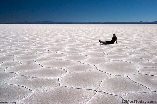
What about salt flats, like in Utah Even salt flats aren't that flat, Mod, they have low and high points over distances (a few yards?) that would show up in such a contact line, and they have cracks in them when dry that would also show at the contact line. Please, this is so clear, so obvious. You could take a yardstick to those strata in the picture and the contact line would be just about as straight. OK, even that can't be perfect but NOTHING I can think of in geological nature is that nearly-ruler-straight, that nearly-tabletop-flat EXCEPT water-deposited strata. abe: Well, for that matter even volcano-deposited strata since those at Mt. St. Helens are awfully straight. ABE: Up close of salt flat:
I think the next one indicates some surface waviness but I'm not sure:
In any case most strata are not salt. . Edited by Faith, : No reason given. Edited by Faith, : No reason given. Edited by Faith, : No reason given. Edited by Faith, : No reason given. Edited by Faith, : No reason given. Edited by Faith, : No reason given. Edited by Faith, : No reason given. Edited by Faith, : No reason given.
|
|||||||||||||||||||||||||||||||||||||||||||||||||||
|
Tangle Member  Posts: 9516 From: UK Joined: Member Rating: 4.8 |
Fiath, if you put a heavy iron on a creased and crumpled towel what happens?
Je suis Charlie. Je suis Ahmed. Je suis Juif. Je suis Parisien. I am Mancunian. I am Brum. I am London.I am Finland. Soy Barcelona "Life, don't talk to me about life" - Marvin the Paranoid Android "Science adjusts it's views based on what's observed.Faith is the denial of observation so that Belief can be preserved." - Tim Minchin, in his beat poem, Storm.
|
|||||||||||||||||||||||||||||||||||||||||||||||||||
|
Faith Suspended Member (Idle past 1474 days) Posts: 35298 From: Nevada, USA Joined: |
If you pile a lot of loose sediment on top of a dry salt lake you'll get a lot of loose sediment in the cracks and not much effect on the straightness factor. If you pile a lot of loose sediment on top of a broad flat field with grass and other green things growing on it you'll get a lot of dead grass under the sediment. or rotted grass if it's wet.
Edited by Faith, : No reason given.
|
|||||||||||||||||||||||||||||||||||||||||||||||||||
|
edge Member (Idle past 1736 days) Posts: 4696 From: Colorado, USA Joined: |
But the Kaibab Plateau is limestone, correct? Is the Coconino plateau also Kaibab limestone?
The top layer is mostly Kaibab in both places.
|
|||||||||||||||||||||||||||||||||||||||||||||||||||
|
edge Member (Idle past 1736 days) Posts: 4696 From: Colorado, USA Joined: |
Even salt flats aren't that flat, Mod, they have low and high points over distances (a few yards?) that would show up in such a contact line, and they have cracks in them when dry that would also show at the contact line. Please, this is so clear, so obvious. You could take a yardstick to those strata in the picture and the contact line would be just about as straight. OK, even that can't be perfect but NOTHING I can think of in geological nature is that nearly-ruler-straight, that nearly-tabletop-flat EXCEPT water-deposited strata. abe: Well, for that matter even volcano-deposited strata since those at Mt. St. Helens are awfully straight.
Nevertheless, these are lake bottoms and they wouldn't have dessication cracks if the water was still present.
ABE: Up close of salt flat: I think the next one indicates some surface waviness but I'm not sure: In any case most strata are not salt. .
|
|||||||||||||||||||||||||||||||||||||||||||||||||||
|
Tangle Member Posts: 9516 From: UK Joined: Member Rating: 4.8 |
Faith writes: If you pile a lot of loose sediment on top of a dry salt lake you'll get a lot of loose sediment in the cracks and not much effect on the straightness factor. If you pile a lot of loose sediment on top of a broad flat field with grass and other green things growing on it you'll get a lot of dead grass under the sediment. or rotted grass if it's wet. And if this later of sediment is 100ft deep, or 100m, or 1m? What then?Je suis Charlie. Je suis Ahmed. Je suis Juif. Je suis Parisien. I am Mancunian. I am Brum. I am London.I am Finland. Soy Barcelona "Life, don't talk to me about life" - Marvin the Paranoid Android "Science adjusts it's views based on what's observed.Faith is the denial of observation so that Belief can be preserved." - Tim Minchin, in his beat poem, Storm.
|
|||||||||||||||||||||||||||||||||||||||||||||||||||
|
edge Member (Idle past 1736 days) Posts: 4696 From: Colorado, USA Joined: |
If you pile a lot of loose sediment on top of a dry salt lake you'll get a lot of loose sediment in the cracks and not much effect on the straightness factor. If you pile a lot of loose sediment on top of a broad flat field with grass and other green things growing on it you'll get a lot of dead grass under the sediment. or rotted grass if it's wet.
Not much grass growing on the bottom of the GSL.
|
|||||||||||||||||||||||||||||||||||||||||||||||||||
|
edge Member (Idle past 1736 days) Posts: 4696 From: Colorado, USA Joined: |
And if this later of sediment is 100ft deep, or 100m, or 1m? What then?
Here is an image of the perfectly flat bedding that Faith is talking about:
[/sarcasm]
|
|||||||||||||||||||||||||||||||||||||||||||||||||||
|
Percy Member  Posts: 22505 From: New Hampshire Joined: Member Rating: 4.9 |
Faith writes: The total lack of any alignment of the canyon with a tectonic fault line is evidence against this big crack model Faith is espousing.
The concept came from this cross section
It's impossible to conclude a crack model from this diagram. It shows just a tiny part of the canyon. As Edge says, the canyon's shape is sinuous - here's a Google Map view of it:
Nothing about this shape suggests it is following fractures in the rock. And if the Kaibab Uplift caused these supposed fractures, how did water continue to flow through the uplifted area?
Since there was another mile or two of strata above the current rim of the Grand Canyon, which is agreed to by standard geology, and evidenced by the Grand Staircase to the north and the butte to the south, the rise would have put strain on the uppermost strata high above the current rim. That's how the cracks developed in my scenario. Why would these wet and malleable (your words) upper strata develop fractures? Why did none of these fractures propagate down to the Kaibab and below so they'd be included in the diagram? And didn't you finally decide the top strata were still loose sediments?
And since this is going on just at the beginning of the draining of the Flood waters, it seems logical that the water, soon laden with chunks of strata,... How would a thin sheet of water only a few inches thick and water levels lowering at a rate of an inch and half per minute be enough to carry chunks of strata? How big are chunks of strata anyway?
...would have widened and deepened the cracks until they became a channel for the recedeing water that eventually became the Grand Canyon. If the etching of the Grand Canyon began in layers above the Claron, then why didn't the widening canyon drain all the water off the plateau and halt the erosion?
You have to account for those extra miles of strata in your scenario too. We do. The plain was at one time much lower in elevation and filled with rivers and streams snaking back and forth across it that gradually eroded the upper layers away. This is something we see taking place around the world today. --Percy
|
|||||||||||||||||||||||||||||||||||||||||||||||||||
|
Modulous Member  Posts: 7801 From: Manchester, UK Joined:
|
Even salt flats aren't that flat, Mod, they have low and high points over distances (a few yards?) that would show up in such a contact line They are so flat you can travel 400 mph in a land vehicle across them. Visible ups and downs over a few yards would make this impossible. Is the stratigraphy considerably flatter than this? Do you have measurements? You are engaged in mystification through pontification here. But you tell me - what happens when you squash something? a) it gets flatterb) it gets less flat What would be the effect of piling rock and earth onto something so it squashes it so much it becomes rock? a) it gets flatterb) it gets less flat c) no impact You could take a yardstick to those strata in the picture and the contact line would be just about as straight. OK, even that can't be perfect but NOTHING I can think of in geological nature is that nearly-ruler-straight, that nearly-tabletop-flat EXCEPT water-deposited strata. Is a lakebed or river remnants NOT water deposited strata somehow? Also - does that mean this coal seam was deposited by water? How does that happen?
Well, for that matter even volcano-deposited strata since those at Mt. St. Helens are awfully straight. So water deposited sediments and volcanic...that covers a lot of stratigraphy doesn't it?
In any case most strata are not salt. But we're talking about lakebeds which sometimes dry out to leave a salt flat or alkali flat. Flat is quite common with these in any case - in contrast to your statement that lakebeds aren't all that flat. How many strata are all that flat? May I ask about Valles Marineris? It's a much bigger canyon than the Grand Canyon. Was this caused by a divine flood too?
|
|||||||||||||||||||||||||||||||||||||||||||||||||||
|
edge Member (Idle past 1736 days) Posts: 4696 From: Colorado, USA Joined: |
May I ask about Valles Marineris? It's a much bigger canyon than the Grand Canyon. Was this caused by a divine flood too?
Please tell me you didn't really ask this question... 
|
|||||||||||||||||||||||||||||||||||||||||||||||||||
|
|
Do Nothing Button
Copyright 2001-2023 by EvC Forum, All Rights Reserved
![]() ™ Version 4.2
™ Version 4.2
Innovative software from Qwixotic © 2024