|

Understanding through Discussion |
|
|
Register | Sign In |
|
QuickSearch
Summations Only | Thread ▼ Details |
|
Thread Info
|
|
|
| Author | Topic: Evolution. We Have The Fossils. We Win. | ||||||||||||||||||||||||||||||||||||||||||||||||||
Faith  Suspended Member (Idle past 1475 days)  Posts: 35298 From: Nevada, USA Joined: |
Percy writes: ringo writes: Faith writes: If it had been formed any number of millions of years ago the eroded material would probably have buried the whole thing by now. How? Isn't most of the eroded material in the Gulf of California? At one time yes, the Colorado dumped its sediment load into the Gulf of California, but then they built Hoover Dam, and now the sediment falls out of suspension once it reaches Lake Mead. Because of demands for water by farming and cities the Colorado actually no longer reaches the Gulf of California except during special releases of water. This is completely irrelevant to what ringo meant. He was just saying that the erosion wouldn't remain in place, it would be transported out of the canyon, so it wouldn't be burying anything. It is urrelevant to his point whether it ends up in the Gulf of California or Lake Mead. I'd simply answer that erosion doesn't merely collect along the river but throughout the canyon in places where it doesn't get transported away. But even that doesn't matter. If those millions of years don't bury the canyon they will at least reduce it all to dust, the point being that if those millions of years were real, which they aren't, the canyon would already be dust. And most likely Lake Mead wouldn't exist because it would have been filled up by now with all that eroded material. Edited by Faith, : No reason given. Edited by Faith, : No reason given. Edited by Faith, : No reason given.
|
||||||||||||||||||||||||||||||||||||||||||||||||||
|
Faith Suspended Member (Idle past 1475 days) Posts: 35298 From: Nevada, USA Joined: |
Unless it's clearly just a local event in which case it has nothing to do with the tectonism in the Colorado Plateau anyway. This is a nonsense objection. Every tectonic event is local to someplace. You seem to have a big problem with my paradigm. I'm sorry about that but it it's not as if I haven't described it enough times, and it does make discussion with you tedious to an Olympian degree to have to deal with your endless objections to every little point. I'm saying that I hypothesize that the tectonic event that caused the Great Unconformity and all the other disturbances in the canyon area was THE tectonic event that split the continents and started the draining of the Flood waters. In other words it had worldwide effects just as the Flood did. A local tectonic event would be an earthquake on the San Andreas fault. It isn't rocket science but you seem to like to make every small point into some kind of totally irrelevant major problem.
There was tectonism local to other places in the world at the same time that there was little or no tectonism local to the Grand Canyon region. I'm postulating one major tectonic event at that time that affected every place else too. Local events have occurred separately all over the place since then. Yes it's my paradigm and you keep answering with the establishment paradigm and I guess that makes you happy but it makes this discussion tedious to the point that I just don't want to continue it.
And vice versa. Your contention that the Grand Canyon region could not reasonably be expected to be relatively tectonically quiet for a sustained period cannot be maintained in the face of the evidence, especially given its distance from tectonic boundaries where tectonism is more common. The one gigantic tectonic event that occurred after the supposed hundreds of millions of years of the quiet laying down of the strata is evidence enough that the canyon area is not so far from tectonic boundaries to be immune. And Geology has never claimed there were no disturbances to the strata during their building up, it's always been assumed that they occurred at least as frequently as they do now. I've been the one to keep pointing out the absence of evidence for that idea, usually in the teeth of objections and denials galore. So now it's become the practice to accept my point and come up with rationalizations such as yours. The idea that there were no tectonic events or other disturbances over those hundreds of millions of years just defies all reason. The only reasonable way to explain this apparent fact is that there were no hundreds of millions of years of deposition, there were no time periods, there was only the continuous rapid deposition of sediments in layers full of dead creatures. Sigh. I just looked through your whole post with the intention of trying to answer it and find it so tedious I don't think I'm up to it. If I get a second wind I'll come back, but I think I'd do better to nurture my own views without all this irrelevant craziness. But who knows, maybe I will get a second wind as I said.
|
||||||||||||||||||||||||||||||||||||||||||||||||||
|
edge Member (Idle past 1737 days)  Posts: 4696 From: Colorado, USA Joined: |
The one gigantic tectonic event that occurred after the supposed hundreds of millions of years of the quiet laying down of the strata is evidence enough that the canyon area is not so far from tectonic boundaries to be immune. And Geology has never claimed there were no disturbances to the strata during their building up, it's always been assumed that they occurred at least as frequently as they do now. I've been the one to keep pointing out the absence of evidence for that idea, usually in the teeth of objections and denials galore. So now it's become the practice to accept my point and come up with rationalizations such as yours. The idea that there were no tectonic events or other disturbances over those hundreds of millions of years just defies all reason.
Indeed it does. That is until you realized that there were several events before the period and that there were things going on all around the plateau in the Paleozoic. There is nothing in plate tectonic theory that says any particular region must undergo deformation every hundred million years.
The only reasonable way to explain this apparent fact is that there were no hundreds of millions of years of deposition, there were no time periods, there was only the continuous rapid deposition of sediments in layers full of dead creatures.
Or that it's irrelevant and that mountain building was going on elsewhere all over the world. Your argument is a strawman. Please feel free to flail away.
|
||||||||||||||||||||||||||||||||||||||||||||||||||
|
edge Member (Idle past 1737 days) Posts: 4696 From: Colorado, USA Joined: |
At one time yes, the Colorado dumped its sediment load into the Gulf of California, but then they built Hoover Dam, and now the sediment falls out of suspension once it reaches Lake Mead. Because of demands for water by farming and cities the Colorado actually no longer reaches the Gulf of California except during special releases of water.
An interesting point here is that not all that much sediment made it to the Gulf of California even before. At present, I am sitting on perhaps hundreds of feet of Colorado River gravels, but I am about 20 miles from the river on the Arizona side. What is not river gravels is mostly sand dunes and some lake sediments.
|
||||||||||||||||||||||||||||||||||||||||||||||||||
|
Faith Suspended Member (Idle past 1475 days) Posts: 35298 From: Nevada, USA Joined: |
Oh, and on my paradigm, mountain building also began with the one major tectonic event when the continents split and the Flood began to recede.
Edited by Faith, : No reason given.
|
||||||||||||||||||||||||||||||||||||||||||||||||||
|
Faith Suspended Member (Idle past 1475 days) Posts: 35298 From: Nevada, USA Joined: |
An interesting point here is that not all that much sediment made it to the Gulf of California even before. At present, I am sitting on perhaps hundreds of feet of Colorado River gravels, but I am about 20 miles from the river on the Arizona side. What is not river gravels is mostly sand dunes and some lake sediments. That is very interesting. I've often wondered where all the Grand Canyon debris went. I accepted the idea that it went down the river to the Gulf of California but I did consider that there should also be piles and piles of it along the way, either in southern California or in Arizona or both, but I couldn't find information about it. So there you are sitting on it or on some of it. Very satisfying to have some idea of it now. I also wonder though if the strata exist below all that debris? Edited by Faith, : No reason given.
|
||||||||||||||||||||||||||||||||||||||||||||||||||
|
edge Member (Idle past 1737 days) Posts: 4696 From: Colorado, USA Joined: |
I also wonder though if the strata exist below all that debris?
There are certainly strata, but not by your definition. This is off the edge of the continent as defined by older continental crust.
|
||||||||||||||||||||||||||||||||||||||||||||||||||
|
Percy Member  Posts: 22508 From: New Hampshire Joined: Member Rating: 5.4
|
Replying again to a number of your messages...
Reply to your Message 1040 to Tanypteryx:
Faith in Message 1040 writes: I was thinking of places where the Navajo did not form anything like a layer but just a large lump of sandstone. What I think you were thinking was, "How can I make it seem like I knew what I was talking about when I really didn't?"
Half a layer? I thought we were talking lumps of sandstone, not layers or half layers at all. I have the same question as Tanypteryx: Are you daft? What is "half a layer?" What qualities does a half-layer have that a full layer does not? I think that in trying to avoid seeming clueless that you're just digging yourself deeper. Replying to your Message 1052 to Tanypteryx:
Faith in Message 1052 writes: What I said is based on how the strata look and what it is like to walk on the rocks is utterly totally absolutely irrelevant. They should not look so uniform if there were different causes and processes involved for different strata. Tanypteryx didn't reply for some reason, so let me give it a try. What are you imagining strata of different types should look like? How should a layer of sandstone differ in appearance from a layer of siltstone shale? They're different in color and texture. Sandstone is deposited in a nearshore environment while siltstone is deposited in quieter waters further from shore, all according to Walther's Law and what we observe taking place along coastlines today. Is there some way in which they should appear different than if they were deposited by a flood that somehow transported these sediments great distances before separating them and depositing them in layers with "knife-edge tight" boundaries, but somehow including erosional elements like streambeds while also insuring that fossils of some types go exclusively to one layer while fossils of other types go exclusively to the other and also scattering about the occasional volcanic effluent (ash or basalt) so as to give the appearance of increasing age with increasing depth.
You really don't know how to assess evidence. I think all the indications point in the other direction. Replying to your Message 1055 to Tanypteryx:
Faith in Message 1055 writes: You have to see them from a distance to see their form. Walking on them won't tell you anything about their form. You can look at a slice of carrot close up or under a microscope and know nothing about its form. Okay. So what is it about the form of the strata (which apparently to you means what exposed layers at the Grand Canyon look like in images you find on the Internet) that represents evidence that they and similar strata the world over were deposited by a global flood? Don't bother to answer, because I see you address this in your Message 1064 to Edge:
Faith in Message 1064 writes: Cross beds are not part of the form, they are a detail related to the sediment which has nothing to do with the form. The whole point here is that I know the Coconino and the Navajo were and are not dunes because they had to be deposited in the same way as all the other strata of other sediments were because of their identical form-- meaning their straight flat form. Well, this creates a couple of questions. Why would a flood be expected to deposit "straight flat" sedimentary layers in ways that ignore density and particle size, and other key factors, too? Does the fact that the layers aren't really straight and flat make a difference (we know they're not straight and flat because the layers vary in thickness, e.g., Coconino: 50-300 feet; Supai Group: 600-700 feet; Redwall Limestone: 400-650 feet; Temple Butte Limestone: 100-1000 feet; and that's just in the Grand Canyon - obviously away from the canyon the thickness of many layers eventually pinches out to 0)? You never answered Edge's question about how you know the Coconino and the Navajo are not dunes. Your claim seems rather odd given the wealth of evidence against it, and exceptionally weak given that your defense was in effect, "I know the flood created all sedimentary layers, therefore the Coconino and the Navajo could not be eolian." Your reasoning is completely backward. You could only know that all layers are non-eolian by inspecting the evidence. In any case, both the Coconino and the Navajo have fossil tracks of lizards and evidence of sand dunes, and the Navajo even contains a number of fossils of land-based creatures. Replying to your Message 1065 to Tanypteryx:
Faith in Message 1065 writes: Tanypteryx writes:
Sure, which is what Old Earthism should do since it misreads all the details as well as the major facts related to the age of the earth. And when a normal person realizes that ALL the details show they are wrong, they abandon their failed paradigm. This is false bravado. The measure of the quality of your ideas is not in your stubbornness and determination and inflexibility in retaining them, but in your ability to muster evidence and argument in their defense. You have much of the former and none of the latter. Replying to your Message 1069 to Tanypteryx:
Faith in Message 1069 writes: The only "fantasy" going on here is your wishful claims that my evidence has failed when it's just that you have zero ability to assess evidence. This is more false bravado. There hasn't been a single instance of your "evidence" succeeding. If you're going to insist that the flood's impact on the world's geology was all a natural event and not a miracle of God then you need to describe evidence that really exists, that is pertinent (unlike your "form of the strata" argument), and that follows known physical laws about the way matter really behaves. Replying to your Message 1073 to Edge:
Faith in Message 1073 writes: If they are flat and straight and sandwiched between other flat and straight strata, that's the evidence that they were deposited just like the others, i.e., in the Flood. Repeating a question asked by others as well as myself, why would a flood be expected to deposit multiple flat and straight well differentiated layers? Replying to your Message 1074:
Faith in Message 1074 writes: The Grand Canyon would be reduced to piles of dust in a lot less time than Old Earthism ascribes to any particular sedimentary rock. And the scree piles are most likely just about as old as the time since the Flood. Only exposed rock erodes. Rock protected by other rock is as fresh as a daisy and will remain so for billions of years. The rate of slope retreat in the Grand Canyon is the same as I reported yesterday, averaging about .02 inches/year, or about 1.6 feet per thousand years. Rock buried deep within the layers of the Grand Staircase region will not turn to dust over time, not even over billions of years. These rocks will persist until exposed to erosion or to some kind of chemical weathering. Replying to your Message 1076:
Faith in Message 1076 writes: From Google page, "How old is the Grand Canyon?
The Grand Canyon is part of the Colorado River basin which has developed over the past 40 million years. A recent study places the origins of the canyon beginning about 17 million years ago. Previous estimates had placed the age of the canyon at 5—6 million years. That's no seventeen million years worth of erosion there or even five to six million. Seventeen million years of slope retreat (erosion) at the rate of 1.6 feet per thousand years is around 5 miles. There are, of course, two slopes, one on the north side, the other on the south side. With each side retreating from the other 5 miles in seventeen million years, they should currently be about 10 miles part. The average width of the Grand Canyon is about 10 miles. The width actually varies quite a bit, from a tenth of a mile up to 18 miles. The products of erosion would simply gather in and fill the bottom of the canyon were it not for the Colorado River, which carries the eroded sediments away. The Colorado has a reputation for being one of the most sediment dense rivers in the country. Replying to your Message 1079:
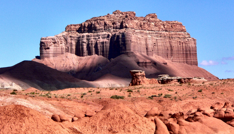
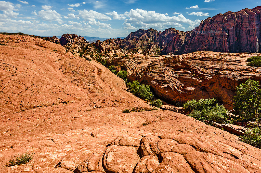
Faith in Message 1079 writes: Yes that's one place the Navajo sandstone didn't form in the geologic column. There are many other places where it also didn't. For reference, this is the image of the Navajo Sandstone that Jar presented:
What make you think this portion of the Navajo Sandstone formed somewhere not in the geologic column? Is it possible for there to be any rock layer anywhere that didn't form in the geologic column? For reference, this is an image of the Wild Horse Mesa in Goblin State Park, Utah. You found a different version of it that you said you couldn't display, but though I had no trouble displaying it myself, it had the word "Stock" written all over it, so I found a better image. Anyway, where in this image do you see the Navajo Sandstone? If you were to find that layer and get up close to it as in Jar's image, what leads you to believe it wouldn't show the same crossbedding?
But the picture I linked shows where it did and it has the same flat and straight form as all the strata. Jar wasn't saying that the upper and lower boundaries of the Navajo are not roughly flat and straight. He was referring to the layers within the Navajo Formation, which obviously are hardly flat and straight and reflect their eolian origin. Replying to your Message 1080:
Faith in Message 1080 writes: Pay attention. If it had been formed any number of millions of years ago the eroded material would probably have buried the whole thing by now. Again, the Colorado carries away the products of erosion.
In hundreds of millions of years it would be reduced to rubble and dust. We can do the math. Let's assume 300 million years, for which the total slope retreat of the two slopes would be 180 miles. That means that in 300 million years that the Grand Canyon will have consumed Flagstaff in the south and, well, looking at a map there are no large cities to the north. Fortunately Flagstaff won't have to worry about this problem for a long time. Reply to your Message 1083:
Faith in Message 1083 writes: It's not an assumption it's just a handy reference point. Since the walls are higher than the hoodoos it would put out more eroded material. The hoodoos are exceptionally soft limestone and erode at a prodigious rate. The walls of the Grand Canyon erode at a much, much slower rate, as the numbers I cited above attest.
I just wanted a number to work with. Again, that number for the Grand Canyon for slope retreat is about 1.6 feet per thousand years.
Any number you can come up with is going to show that the canyon walls are going to break down in far less than millions of years,... This is obviously untrue.
...meaning they should already be collapsed into dust on the Old Earth system. What is it with you and thinking rocks will turn to dust merely through the passage of time? Unless rock is somehow exposed to the elements, either by being directly exposed or through subjection to water coming in through cracks, rock will last virtually forever. We have wood that is thousands of years old. We have mud bricks that have lasted for thousands of years. Buried rock protected from the elements will last virtually forever. Replying to your Message 1085:
Faith in Message 1085 writes: Yes you have to take the different kinds of rock into account certainly. The monuments are sandstone and they are probably eroding more slowly than the hoodoos but they are still eroding. Yes, of course. But unexposed rock is not slowly turning to dust.
And the canyon walls are eroding. Yes, at the average rate of 1.6 feet per thousand years.
Mudstone erodes pretty fast I understand. You figure it. Figure it for five million years. It shouldn't even be there now if it really was that old. Naturally the makeup of the canyon walls shifts in different parts of the canyon depending upon which layers are exposed. Some layers erode quickly, some slowly. Soft layers below hard layers can erode away leaving nothing to support the upper hard layer and causing large chunks of it to break off and fall into the canyon. Soft layers above hard layers deposit large loads of scree on the shelf of the hard layer, protecting the lower portions of the soft layer from some of the effects of weathering and erosion. But eventually all the products of erosion find their way to the canyon bottom (gravity will not be denied), and then the Colorado River will carry them to Lake Mead. Replying to your Message 1109:
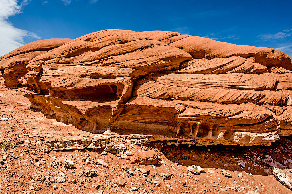
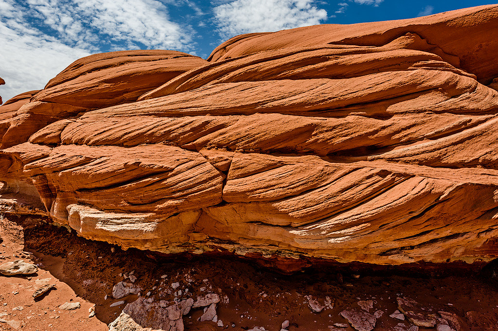
Faith in Message 1109 writes: I said quite a while back that I picture lumps of Navajo sandstone rather than strata. This makes as little sense now as it did then. What is it about the Navajo Sandstone that to you says it should be pictured as lumps? What are the lump boundaries? It is the crossbedding of the sand beds that you're thinking of? If so, how do you picture the flood performing this diagonal sand cross bedding while providing a "knife-edge tight" boundary at the top and bottom of the layer?
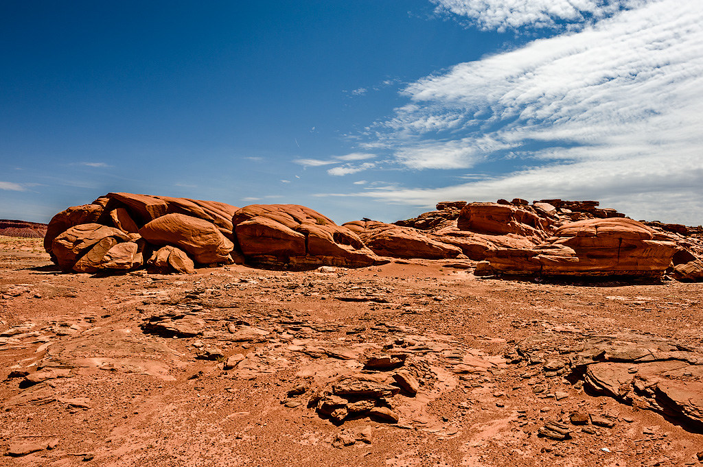
Turns out of course there are also strata,... Yes, the Navajo Formation is a layer of strata. It is not "lumps".
...but I was thinking of some photos that were posted I think by Tanypteryx on a thread about his trip to the Southwest, such as Message 13... It isn't that hard to bring images into a message, so here ya go. As Edge said, they're outcroppings of eroded remnants of the Navajo Formation. They don't represent some novel way of creating rock. They were once part of the same straight and flat Navajo Formation that you see embedded in mesas and so forth.
--Percy
|
||||||||||||||||||||||||||||||||||||||||||||||||||
|
edge Member (Idle past 1737 days) Posts: 4696 From: Colorado, USA Joined:
|
Repeating a question asked by others as well as myself, why would a flood be expected to deposit multiple flat and straight well differentiated layers?
I'm having an exceedingly hard time visualizing Faith's depositional scenario. Maybe someday it will crystallize, but I'm pretty sure that if that happens it will be seen as a complete failure. From everything we know about rapid deposition, we see that such sediments are poorly bedded, impure. and of highly variable thickness with rough tops and gouged bottoms. They are often called 'immature' sediments. We do not see this everywhere in the geological record. If you load one sediment rapidly with another, it is usually uneven loading. This causes disruption of original texture and destruction of fossils. Same thing with the liquefaction argument that some YECs like to expound. And 'wet sediments' make it even worse. It would be a chaos. We do not see this everywhere in the geological record. To transport coarse clastic sediments, very high fluid velocities are need for extended periods of time to cover a continent to the depths present. Admit it or not, Faith needs a high-velocity mudflow that should leave behind some kind of evidence such as that we see for high-velocity ash flows on volcanoes. But that is not what we see in the geological record. In fact, what Faith proposes would produce the opposite of what we see exposed in the geological record. So, what is the attraction? Simple adherence to a religious belief system that must be validated.
|
||||||||||||||||||||||||||||||||||||||||||||||||||
|
Percy Member Posts: 22508 From: New Hampshire Joined: Member Rating: 5.4 |
edge writes: All very true, but specific ages for a formation are a bit hard to nail down. Most major formations are time-transgressive. In other words, they are of different ages at different places. Understood. I was trying to give the ages at the Grand Canyon.
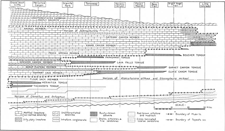
In point of fact, the Tapeats grows younger as you go from southwest to northeast. In this cross-sectional diagram, the Tapeats is the white field that traverses from lower left across the page. The Great Unconformity is shown as a wavy line at the base, rising upward toward the continental land mass to the right. It is overlain by a coarse conglomerate derived locally from emergent lands to the right (east). This image is fascinating:
I was trying to figure out exactly what area is shown on the diagram, and I see the Little Colorado off on the right side, so this must be maybe 150-200 miles east of the Grand Canyon area? I don't see a vertical scale, but it must be greatly exaggerated since the horizontal extent must be over a hundred miles. Still, what this diagram shows is dramatically different from the cross sections revealed at the Grand Canyon that convince Faith that sedimentary deposits are always deposited in straight, flat sheets. Let me know if I"m misreading the diagram, but this seems to be showing several things not apparent or not present at the Grand Canyon:
Anyways, I wouldn't make too much of the difference in ages between the Tapeats and the Bright Angel. One implication of Walther's Law is that any formations continuously deposited, one after the other, will also be of the same age at some point. This of course, fails if an unconformity is present. But shouldn't the difference in age between the Tapeats and the Bright Angel at any given spot represent the time it took for the transgression to change from coastal to nearshore?
And actually, I have no problem with calling it a beach deposit if we are including all of the wave action zone where sand is being winnowed and graded by waves. Yeah, me either, but it calling it a beach seemed to be something Faith was getting bogged down on. I see the Little Colorado parallels Route 66 for a stretch. I've never been on it (I guess it's Route 40 now), but there was a show in 1960 called Route 66 about a pair of friends who cruised up and down the highway in their Corvette having adventures. --Percy
|
||||||||||||||||||||||||||||||||||||||||||||||||||
|
Minnemooseus Member  Posts: 3945 From: Duluth, Minnesota, U.S. (West end of Lake Superior) Joined: Member Rating: 10.0 |
You're forgetting that, as in most geologic diagrams, that the vertical dimension is exaggerated. This is more accurate:... It appears, per the vertical and horizontal scales, that even your less vertically exaggerated version still has roughly a x4 vertical exaggeration. Regardless, I would be cautious about over-interpreting that diagram. I suspect to some degree it is a "cartoon" - Something to illustrate relationships while not actually being precisely accurate. OSLT. Moose Edited by Minnemooseus, : Accidentally submitted while doing scaling experiment. Edited by Minnemooseus, : Fix quote box.
|
||||||||||||||||||||||||||||||||||||||||||||||||||
|
edge Member (Idle past 1737 days) Posts: 4696 From: Colorado, USA Joined: |
Let me know if I"m misreading the diagram, but this seems to be showing several things not apparent or not present at the Grand Canyon:
I don't know that the conglomerate is there at all locations, but I'm sure it is quite thin except for adjacent to the monadnocks. Most images I've seen have at least a few pebbles at the contact.
The Tapeats doesn't rest directly upon the Great Unconformity but has a layer of "coarse conglomerate" beneath it. The bottom of the Tapeats seems to be stepped, perhaps reflecting brief reversals in the transgression from southwest to northeast.
That's a bit of an artifice to show a climbing, time-transgressive unit, possibly with minor regressions.
There is no Bright Angel Shale here atop the Tapeats. Seems odd. It seems like a layer of some kind of siltstone/mudstone/claystone should reside atop the Tapeats, or that there should be a disconformity. But no, the layer above the Tapeats is the Muav.
I have a feeling that they combine the Tapeats and Bright Angel, or maybe this diagram had a specific purpose that I do not know. Actually, I don't really care for the diagram. I like the one that you found better because it doesn't have all of the unit names to confuse the issue. Lots of times geological diagrams are too complex, probably people just showing off.
How could there be a rapid transition from coastline to shallow sea?
Just your standard transgression. This continental boundary became a passive margin in the late Proterozoic. It was probably pretty flat and near sea level at the time. There was no reason for disturbance until the Atlantic Ocean completely closed and then started opening in the Permian.
The top of the Tapeats that borders the Muav seems to be very irregular. Does this reflect an irregular disconformity, or reversals of the transgression? Something else?
It is a transitional contact with some extensive 'tongues' of one environment extending into another, probably related to changes in sea level. So, while the general trend was toward transgression (the Sauk transgression), there were minor reversals.
But shouldn't the difference in age between the Tapeats and the Bright Angel at any given spot represent the time it took for the transgression to change from coastal to nearshore?
At a given point, sure. The problem is that the point is dynamic and will change with time. I sometimes cringe when people say that a formation is of a certain age. Actually, it is a range of ages and those ranges are different in different locations. So when YECs say that there is a 10 million year gap between two formations, it's really kind of meaningless. But it sounds like a horrible 'problem' to a lay person.
Yeah, me either, but it calling it a beach seemed to be something Faith was getting bogged down on.
Well, if she expected to see beach chairs and cabanas, she would be disappointed.
I see the Little Colorado parallels Route 66 for a stretch. I've never been on it (I guess it's Route 40 now), but there was a show in 1960 called Route 66 about a pair of friends who cruised up and down the highway in their Corvette having adventures.
I remember that too. There isn't much of the road left. However, there is a statue of a flat-bed ford on a corner in Winslow, Arizona. Edited by Adminnemooseus, : Added link at end. There is a statue of a man and a guitar, but no statue of a flat-bed Ford (although there is supposed to be a mural containing said Ford). A statue of Glen Fry was later added somewhere there, in 2016.
|
||||||||||||||||||||||||||||||||||||||||||||||||||
|
edge Member (Idle past 1737 days) Posts: 4696 From: Colorado, USA Joined: |
Regardless, I would be cautious about over-interpreting that diagram. I suspect to some degree it is a "cartoon" - Something to illustrate relationships while not actually being precisely accurate.
Exactly true.
|
||||||||||||||||||||||||||||||||||||||||||||||||||
|
Tanypteryx Member  Posts: 4451 From: Oregon, USA Joined: Member Rating: 5.5 |
Tanypteryx didn't reply for some reason, so let me give it a try. I apologize for dropping out of the conversation. That was kind of the first time I have been active in a while. I have a pinched nerve in my lower back and so was having to lay flat and not do much for a few days. Then it started getting better and I had to get back to my current photomicrography research project and make up for the days I missed. Today I spent too much time shooting and sitting at the computer and my back is giving me fits again. Sometimes Faith's responses seem completely incoherent and I just feel it is futile to carry on with her. Her denial of the implications of the crossbedding in the Navajo when we can all see it in the photos is totally daft.
Faith in Message 1064 writes: writes:
Cross beds are not part of the form, they are a detail related to the sediment which has nothing to do with the form. The whole point here is that I know the Coconino and the Navajo were and are not dunes because they had to be deposited in the same way as all the other strata of other sediments were because of their identical form-- meaning their straight flat form. And then there is stuff like this....
Faith in Message 1079 writes: writes:
Yes that's one place the Navajo sandstone didn't form in the geologic column. There are many other places where it also didn't. Her self contradictions are mind boggling, over and over and over............ You did a great job answering her, but she says she doesn't read it, how sad for her.What if Eleanor Roosevelt had wings? -- Monty Python One important characteristic of a theory is that is has survived repeated attempts to falsify it. Contrary to your understanding, all available evidence confirms it. --Subbie If evolution is shown to be false, it will be at the hands of things that are true, not made up. --percy The reason that we have the scientific method is because common sense isn't reliable. -- Taq
|
||||||||||||||||||||||||||||||||||||||||||||||||||
|
Faith Suspended Member (Idle past 1475 days) Posts: 35298 From: Nevada, USA Joined: |
I'm sorry, I simply can't get through the previous barrage of posting with all its bizarre misrepresentations and accusations of me. I'm not feeling well and I need to avoid the stress of all this for one thing. So I'm going to try to stay away for a while but I need to make this post for sure.
First the idea that the Flood couldn't lay down the strata I find strange. I would have thought it would be common knowledge that rivers and other bodies of water can do just that, so certainly the worldwide Flood could, and the fact that the strata in question are gigantic formations with an enormous number of fossils certainly fits the Flood's dimensions and purpose of killing all air-breathing creatures. Anyway, I went and found Bertault's experiments with strata on a You Tube video to make it clear that water does indeed lay down separated layers of sediments without mixing them. I'm posting Part 2 of this four-part film (each about 7 to 9 minutes long) because the first part is general introduction to stratigraphy and the observations and experiments start in Part 2. The first observation he makes is of strata twelve feet deep formed by a high-velocity river. Start about 45 on the counter to see the strata the river produced in one continuous flow: From 3:00 to 4:00 he shows how strata or laminae form with dry sediment in a flask. From 4:55 he's showing sedimentation experiments in a flume in Colorado. This shows that strata form in moving water both vertically and laterally simultaneously, which is a confirmation of Walther's Law, and a challenge to the idea that strata form slowly by superposition. The video rolls over to the next part (Part 3) after about four minutes, where strata are seen to be forming simultaneously one on top of the others in relation to the velocity of the current. This shows that Steno was wrong about superposition and continuity. Right after this it's shown that he was also wrong about the principle of horizontality as strata are seen depositing on quite a steep slope. I had watched this presentation a long time ago when I didn't understand the implications of it. At that time I was interested in the fact that strata form so readily in water. But it is quite a revelation to me now because it challenges all Steno's laws, confirms Walther's Law which I didn't know about the first time I watched it, and pretty much decimates the principles Geology today takes for granted about the formation of strata. For instance in this Part 3 around 5:20 he shows how fossils are not deposited according to age but that an older one can be buried in a layer above a younger one. So much for fossil order! From about 6:00 in Part 3 he starts talking about how the Tonto Group in the Grand Canyon would have been formed according to the principles shown in the flume experiments, which is continued in Part 4. where he concludes that based on the hydraulic experiments in the flume the seventy million years ascribed to the Tonto Group is false and that it could have formed in days or weeks. So, experiments which you can see for yourself in this film abolish Steno except for the one condition of deposition in still water, abolish the millions of years claimed for deposition of the geological column, and abolish the fossil order. YET WHO TALKS ABOUT THIS? ============But I also want to keep some of the crrent discussion going too: As far as I can tell nobody is addressing the "other line of evidence" argument about the rate of erosion of various formations such as the hoodoos of Bryce canyon, the monuments of Monument Valley, and the Grand Canyon itself, the argument being that if they've been in existence for millions of years they all should be eroded down to dust by now, because the actual erosion as judged by the piles of it at the base of each formation, is nowhere near, NOWHERE near such an age. If someone has addressed this forgive me for overlooking it. I think it's open and shut myself but I'm sure y'all can come up with some kind of rationalization to keep your millions of years intact. Otherwise this topic is wandering around all sorts of side issues now to no good purpose that I can see. I do believe, of course, still, that strata would not be laid down over the Kaibab Uplift of the Grand Canyon, which proves that they were laid down before it and their lack of any kind of disturbance during their laying down, but only afterward, shows that they were laid down rapidly and not millions of years apart. All the disturbance in that area came afterward and the Kaibab Uplift was part of it, which I attribute to the tectonic disturbance beneath the canyon that pushed up the Supergroup. The Supergroup pushed up the Paleozoic strata, the strata that had been a mile or more deep above the Permian/Kaibab level broke up and washed away, the cliffs were cut in the Grand Staircase, the Hurricasn Fault occurred, the magma dike near that fault occurred, originating under the Tapeats with all the other basement rock disturbances, the Grand Canyon was cut as was Zion Canyon and so on and so forth. I'm just restating my view of it to keep it on the record. I find all the objections to it to fail, just Old Earth dogma or misreadings of some sort or another. Some of this may change as I digest the video. I really don't feel well but I suppose I may be interested in any comments on what I've posted here. Edited by Faith, : No reason given. Edited by Faith, : No reason given. Edited by Faith, : No reason given. Edited by Faith, : No reason given. Edited by Faith, : No reason given.
|
||||||||||||||||||||||||||||||||||||||||||||||||||
|
|
Do Nothing Button
Copyright 2001-2023 by EvC Forum, All Rights Reserved
![]() ™ Version 4.2
™ Version 4.2
Innovative software from Qwixotic © 2024


 (1)
(1)