|

Understanding through Discussion |
|
|
Register | Sign In |
|
QuickSearch
| Thread ▼ Details |
|
Thread Info
|
|
|
| Author | Topic: The TRVE history of the Flood... | |||||||||||||||||||||||||
Faith  Suspended Member (Idle past 1475 days)  Posts: 35298 From: Nevada, USA Joined: |
You mention Coyote's questions. I can't find them. Please keep in mind that sometimes I can't digest everything in your posts; probably often. Sometimes it's a big accomplishment to get any of it and the rest has to be ignored. I'm used to Coyote mostly making remarks about radiometric timing and may not have read the post you are talking about in the first place. And I usually regret having any conversation at all with Pressie so I wouldn't get that reference either. You're hard enough to deal with hut there are others who are actually harder.
AND: I don't expect to match anybody's experience. If it's clearly articulated it can be very helpful to hear about it, but sometimes people are good workers in their field but not good with words. If I get a clear picture of what someone is talking about then it may raise questions that help organize my Flood point of view, not that such a result would please you of course.
|
|||||||||||||||||||||||||
|
Faith Suspended Member (Idle past 1475 days) Posts: 35298 From: Nevada, USA Joined: |
In Message 477 I posted a chart of the Cratonic Sequences and raised the question how those separate transgressions of the sea, all supposedly shallow, all laying down some depth of strata, didn't rise to a great height, even about as much as the Flood of Noah, since each had to surmount the previous depth of strata. Other problems were noted in subsequent posts, such as a discrepancy between the depth of the Sauk sequence and the depth of strata it supposedly laid down.
I was answered that subsidence of the land could be the explanation and I explored that possibility in a later post. But nobody gave any information about whether or not subsidence is considered to have occurred. As I recall none of this was considered by the resident Geologists. I would still like to hear how they account for the necessary great depth of the water at the end of all those separate transgressions. Thank you.
|
|||||||||||||||||||||||||
|
Faith Suspended Member (Idle past 1475 days) Posts: 35298 From: Nevada, USA Joined: |
You mention Coyote's questions. I can't find them. Please keep in mind that sometimes I can't digest everything in your posts; probably often. Sometimes it's a big accomplishment to get any of it and the rest has to be ignored. Well, like with so many disciplines, people spend years studying these things at university. I can't apologize for it being a complex science. I wasn't asking you to apologize, if anything I was apologizing. At least I wanted to make you aware why I can't address everything you post and may need repetitions of this or that.
I'm used to Coyote mostly making remarks about radiometric timing and may not have read the post you are talking about in the first place. And I usually regret having any conversation at all with Pressie so I wouldn't get that reference either. You're hard enough to deal with hut there are others who are actually harder. Well, Pressie is a bit impatient, but it wouldn't hurt to learn something from his posts. Coyote has a different approach being an archaeologist, but the tools and reasoning are very similar to geology. I understand both. If I can't grasp the information, and Pressie for one seems to go out of his way to make things as difficult as possible -- giving information about South Africa for instance when I asked for information about North America -- forget it, the discussion is simply being sabotaged. Perhaps that's the intent.
AND: I don't expect to match anybody's experience. If it's clearly articulated it can be very helpful to hear about it, but sometimes people are good workers in their field but not good with words. If I get a clear picture of what someone is talking about then it may raise questions that help organize my Flood point of view, not that such a result would please you of course. The impression is that you are not learning anything; in fact it seems more that you refuse to learn anything. That is frustrating to people who have spent their careers studying a scientific profession. In fact, in many cases, it is insulting. I am a creationist, I try to learn whatever I am able to learn and especially if it addresses my creationist concerns. Perhaps impatient and irritable geologists shouldn't try to talk to creationists.
|
|||||||||||||||||||||||||
|
Faith Suspended Member (Idle past 1475 days) Posts: 35298 From: Nevada, USA Joined: |
The information about the unconformities was supposed to lead to a new phase of the discussion, but there was not enough information to allow me to grasp the point of any of it. Meanwhile the question of the rising sea water needed to cover the accumulating stack of sediments laid down by the separate shallow transgressions was never answered. The unconformities were then brought up in a way that brought the whole topic to an end.
Message 565 and 566
NEVER MIND. I found the Morris article, so I'll read it and get back to the thread eventually. Makes me happy too because the idea of the unconformities led me to the same explanation he came up with. Anyway, back to it later. The St. Peter Sandstone | The Institute for Creation Research Edited by Faith, : No reason given. Edited by Faith, : No reason given.
|
|||||||||||||||||||||||||
|
Faith Suspended Member (Idle past 1475 days) Posts: 35298 From: Nevada, USA Joined: |
There's nothing I can say about your dates except that they are wrong by the dating of the Flood. All we can do is continue to disagree about that.
I think I answered what you said about the scablands though -- not a flood on the scale of Noah but the flooding of water that was left standing after the Flood, and apparently iced over as well.
|
|||||||||||||||||||||||||
|
Faith Suspended Member (Idle past 1475 days) Posts: 35298 From: Nevada, USA Joined: |
You are somehow absolutely missing the point. What? A basin here and there answers this question? Hardly!
The subsidence of BASINS does not explain one thing about how the LEVEL OF THE LAND had to rise with each transgression of the Cratonic sequences. The water would have had to rise to cover each new level of strata in turn. The uppermost level of your basins, i.e. the rims, would have to have been surmounted by the water at the very least, but this is all a distration anyway. Basins are NOT characteristic of the ENTIRE SPAN OF THE STRATA across the continent. AND they would have formed after the strata were all laid down anyway, and not during the transgressions which is what the question is about. The subsidence required to make the rise of the water unnecessary would have to have sunk the entire continent to admit the next transgression without a rise in sea level. I gather from the utterly inadequate answer about basins that there was no such subsidence that would have made extreme sea level rise unnecessary from transgression to transgression. I refer you back to Message 477 for a complete presentation of the original question you were supposed to be answering but didn't. I'll try to track down subsequent posts that addressed subsidence. There is no other conclusion but that the necessary subsidence did not happen. In other words the water WOULD have had to rise just about to the level of Noah's Flood by the time the entire stack was laid down. In fact I'm going to declare that this fraud of an answer to my questions means that the water DID rise to the level of Noah's Flood. It had to. There was no sinking of the entire continent, the strata kept building higher with each transgression. The transgressions were phases of the Flood. The timing given by Geology is a big fat delusion. The Cratonic Sequences are explained by the Flood and the rest of this discussion is obfuscation. Edited by Faith, : Add underlining
|
|||||||||||||||||||||||||
|
Faith Suspended Member (Idle past 1475 days) Posts: 35298 From: Nevada, USA Joined: |
Here's a subtopic I'm not really up on that could maybe inspire me to find out more if it turns out to be interesting enough as well as something I can understand, which I don't know. A muddled bunch of thoughts about how air conditioning/refrigeration works, in response to the claims that Floodist speeds for the movement of the plates would produce enough heat to vaporize the planet. How about enough to vaporize enough ocean water to bring on the ice age?
This would involve less catastrophic ideas about the heat generated by continental movement but still assume quite a bit of heat. Just how much energy is needed to move the continents? I get the basic idea about the application of E=mc2 but keep thinking of factors such as that 1) momentum after launch can't possibly require all that much energy: give a ball a push to get it rolling down a slight slope and how much energy is required after the initial push? The continents ride on a molten base? Once moving how much energy would that take to keep moving? (Seems to me it would take a lot more energy to stop the movement). And 2) The movement of the plates occurs deep in the ocean beneath some enormous volume of cold water. Is that as negligible a factor as everyone seems to be implying? (How much heat is being generated by subduction? By the spreading sea floor? By the rising of the magma at the Atlantic ridge? How much by a volcano? How about a whole phalanx of volcanoes erupting at once? Just some ponderings. Hit me with your answers. Edited by Faith, : No reason given. Edited by Faith, : No reason given. Edited by Faith, : No reason given. Edited by Faith, : No reason given.
|
|||||||||||||||||||||||||
|
Faith Suspended Member (Idle past 1475 days) Posts: 35298 From: Nevada, USA Joined: |
The question wasn't about how deep the sediments can get here or there, which certainly could get very deep in basins, but about how deep the water had to get across the entire continent in order to lay down one block or "package" of sedimentary layers after another, each to as much as 1000 feet deep. This would require each subsequent transgression to surmount the previous depth with a similar depth of water in order to lay down the next block of sediments. With six of these transgressions each adding a similar amount of sediment to the growing column of layers, the sea level would have had to rise as much as two miles or so by the time it was all laid down (this amount takes into account "unconformities" or layers that were laid down in the transgression but removed in the regression). And that amounts to a depth of water approaching that of Noah's Flood. (Again, I raised the questions in more detail in Message 477
If you look at the cross sections of the basins that edge posted you can see that the entire column of layers sank all as one block in each case, meaning AFTER it was all laid down. The thinning of the edges with thickening of the lower part shows the layers were not deposited into the basin -- which would have produced an even thickness as shown in various experiments -- but were originally laid down horizontally, and then the whole area sank to form the basin) It is therefore completely unrelated to the questions I've been asking. The suggestion that subsidence of the land would allow for the lowering of the sea level required to cover all the layers laid down in six SHALLOW transgressive sequences, could only work if the subsidence was continent-wide and occurred to the depth of each transgression at the time of the transgression. Basins certainly don't meet that requirement. Side point: Since the layers in many cases extend completely across the continent (described in the following article for instance) this certainly implies a completely denuded landscape, nothing where creatures of any time period would ever have roamed, (see thread on this subject) but in fact describes what would be expected of the worldwide Flood.
What the Cratonic Sequences contribute to the Flood picture is the idea that it occurred in periodic transgressions and regressions, perhaps caused by tides. The following article is from ICR on the by John D. Morris on the Cratonic sequences (or megasequences as he calls them). He explains the unconformities that mark each sequence as erosion during the regressive phase of each transgressive sequence:
Recognition of the fact that the sedimentary geologic layers are not separate entities, but are grouped in packages, came through plotting the sediment types, location, and ages on the continental scale... Each grouping of sedimentary layers contains features best understood in the sense of a transgression of the ocean onto the continents, followed by a regression back into the sea and the resulting erosion, followed by a second sequence, and then another. .. During transgression, the waters brought and deposited sediment (usually marine) on the continent. During regression, the waters eroded much newly deposited and older sediments as they ran off the continents, producing a recognizable erosional boundary called an unconformity. The six (or more) megasequences ...have been correlated with beds right across North America and even onto other continents... Each sequence begins with a basal sandstone containing sand grains of lessening diameter as one moves upward through the layer. This is typically covered by shale or siltstone composed of tiny particles, which in turn is covered by extremely tiny, precipitated particles. The lowest megasequence is the Sauk Megasequence, which was followed by an erosional unconformity. The overlying megasequence is called the Tippecanoe Megasequence ... also followed by an unconformity. On the entire continent, no mountain remained, for the St. Peter Sandstone covers essentially the entire continent with a sheet of sand roughly three thousand miles by one thousand miles in area, yet less than 300 feet thick! ... Edited by Faith, : No reason given. Edited by Faith, : No reason given.
|
|||||||||||||||||||||||||
|
Faith Suspended Member (Idle past 1475 days) Posts: 35298 From: Nevada, USA Joined: |
Basins have NOTHING to do with the layers of the Cratonic Sequences.
|
|||||||||||||||||||||||||
|
Faith Suspended Member (Idle past 1475 days) Posts: 35298 From: Nevada, USA Joined: |
So Admin has informed me that your basin images are apparently intended to demonstrate how thick sediments can form without water?
May I ask what would be the point of that? And what does it have to do with my questions?
As this diagram shows, sedimentary formations of the Phanerozoic can be very thick on the edges of the continents or basins, and thin toward the center of the continental landmass. So that the oceans do not have to be as deep as you seem to think they should be to stack a very thick package of sediments. I have no idea what you are trying to prove, or why "stack[ing] a very thick package of sediments" is what you want to prove. This cross section shows an area where the whole geological column has already been laid down and was afterward deformed by that major slope to the right or South. What this has to do with deposition with or without water totally escapes me, as well as how any of it relates to the problem of laying down a couple miles deep of sedimentary layers across a whole FLAT continent without requiring that high a rise in sea level.
As you go to the left, the formations become fewer and they become thinner; and in some cases can pinch out completely. Part of this effect is due to later erosion, but I think it's pretty clear that thicker sections are outbound from the continental core. Which means what? Seems to me that the strata were first laid down to their complete depth, and then something caused them to tilt to the right/South, subsidence beneath the area I suppose, and if this occurred while they were still wet then those on the left would have drained, or run, to the right, as apparently they all did, which is what caused them to thin at the left and thicken at the right. Of course your timing will be very different from mine, as will your explanation of what happened. However, nothing in this or any of the other images relates at all to my questions about the necessary level of sea level rise in order to lay down ALL the layers in ALL the sea transgressions of the Cratonic Sequences.
Sometimes the subsidence is accompanied by uplift along fault zones. Here is a cross section of the Paradox Basin where the ocean would be to the left and the basement rocks have been uplifted along a fault and shed coarse debris (conglomerate) into the basin on the right side and more fine grained sediments out into the sea. But the subsidence that has to occur in order to lay down all the layers in all the cratonic sequences across the entire continent which was a flat featureless explanse, would have to be the subsidence of the entire continent, and to depths and in timing phases that correspond with each of the depositions of each of the "packages" of sedimentary layers. Subsidence in a basin that occurred after all the layers were laid down is utterly irrelevant.
Again, I don't see how to get this pattern without some kind of relative subsidence of the basin. I'm not sure what "pattern" you are talking about, but in any case none of this has to do with the fact that sea level had to rise a couple of miles to cover all sediment deposited by the sequences from the Sauk through the Tejas. Then Hawaii:
This is evidence for crustal rocks subsiding into the asthenosphere to form basins that can accept thicker sequences of sediments. But unless the entire North American continent subsided to accommodate each transgression with its sedimentary deposits in turn, all this doesn't address the problem I've raised.
|
|||||||||||||||||||||||||
|
Faith Suspended Member (Idle past 1475 days) Posts: 35298 From: Nevada, USA Joined: |
"Thicker and more numerous in the basins?" I'm sorry but I can't begin to fathom what this has to do with the problem I'm posing.
What do basins have to do with layers deposited flat all the way across the continent? What do basins in which all layers were already formed have to do with the problem of sea level rises required to cover each transgression's sedimentary deposits, ultimately to the point where it's had to rise as high as Noah's Flood would have? Or just about,(allowing for all that time assumed between the sequences). That is, the known geological column is a few miles thick. Whether it was laid down in "packages" by six separate transgressions of the sea, or one at a time, over hundreds of millions of years, the level of the sedimentary deposits would be rising with each deposition, so the water which deposited them also had to rise to cover it all. And that means it had to rise just about as high as Noah's Flood. Which makes this whole scenario good evidenced for that event. If you are saying something about deposition without water, where in the column did that occur? Edited by Faith, : No reason given.
|
|||||||||||||||||||||||||
|
Faith Suspended Member (Idle past 1475 days) Posts: 35298 From: Nevada, USA Joined: |
1. Evidence for subsidence. Subsidence in a basin has absolutely nothing to do with the subsidence necessary to solve the problem of needing sea level to rise a couple of miles to lay down layers across the entire continent.
2. Thinning of the cratonic sequence over the continental crust. The latter is another concept that I'd like to introduce because Faith has complained the the water has to get exceptionally deep in order to deposit the cratonic sequences on higher parts of the craton; I haven't said anything about "higher parts of the craton," I'm talking about the entire geological column being laid down across the entire continent, which means both high and low areas.
and therefor must have been due to the flood. My point is that, no, it doesn't need to be all that deep. It would have to rise to the higher parts of the craton in the first place and then to the level of the sediments deposited on it, but again I haven't said anything about the craton itself. The layers of many of the sediments in the column span the continent and they span it miles deep. Doesn't matter where the craton is, to lay down sedimentary layers that deep means the sea had to rise to cover it all miles deep.
My last diagram was to show how the crust (continental or oceanic) can sink into the asthenosphere during subsidence. Which again has no relevance that I can see to what I'm talking about, unless there is evidence that the entire continental crust of North America sank into the asthenosphere by stages in tandem with the depth of each of the transgressive sequences.
I didn't expect such a agressively disagreeable reaction. OK, I'm sorry for the anger, but the incredible irrelevance of your response hit me as deceitful. Apparently it wasn't, so I'm sorry. But nevertheless it seems to be utterly irrelevant. (I guess it doesn't matter how much you insult me, right, if I insult you it's a major offense.) Edited by Faith, : No reason given. Edited by Faith, : \\\\\\\\\\
|
|||||||||||||||||||||||||
|
Faith Suspended Member (Idle past 1475 days) Posts: 35298 From: Nevada, USA Joined: |
Clearly, the sediments are not uniform across the continent. They don't have to be "uniform," just originally laid down flat, as Morris also said.
These diagrams, based on oil exploration are pretty conclusive. "Conclusive" about what?
But they weren't already formed. The layers show the same transgressive sequence as the crattonic sequences. I described why they were already formed. The basin formed after they were all in place. I'll review the evidence later. They SHOULD show the same transgressive sequences even in that case, though I don't know what shows that.
... have to do with the problem of sea level rises required to cover each transgression's sedimentary deposits, ultimately to the point where it's had to rise as high as Noah's Flood would have? They show that the layers thin and pinch out as higher levels of the craton are approached. Therefor sea level did not reach the deep-water proportions that you surmise. I gave a much better reason for the pinching out, but leaving that aside for the moment, why should the height of the craton have anything to do with how much water it would have taken to lay down the entire geological column across the continent? The regressing water would have caused the "unconformities" as Morris described, by eroding them away, so would also have eroded sediments on the higher craton. It should simply have erased the upper layers, not pinched them out. The thinning could have been the effect of deposition over the higher land, but could just as well be the effect of the sinking of the strata into the basin AFTER they were all laid down. Since the image is of a basin and not flat deposition over the craton. But again, there is nothing in what you've said to change what I described. Presumably the transgressions laid down the entire geological column to a depth of miles, because that is seen in many places, especially of course in the Grand Canyon, and that requires the rising of the sea level as I described. The presence of the craton has nothing to do with that.
Whether it was laid down in "packages" by six separate transgressions of the sea, or one at a time, over hundreds of millions of years, the level of the sedimentary deposits would be rising with each deposition, so the water which deposited them also had to rise to cover it all. Except for the simple fact that we know subsidence occurs. That is indisputable from the diagrams (and many more, if you want) that I presented. The transgressions would have to have surmounted the highest level of deposition laid down by the previous transgressions, and surmounted it by the depth of the current deposition to lay down the next thick "package." Your local basin subsidences are utterly inadequate and irrelevant to that requirement. You would need subsidence to the level of each transgression to keep the sea level that low. AS I'VE SAID a million times already.
We also know that there is a mechanism for subsidence which includes loading by sediments. Of course. I discussed that dozens of posts ago. But there is no evidence that the necessary extent of such a subsidence ever occurred. Your basins don't cut it.
And that means it had to rise just about as high as Noah's Flood. Which makes this whole scenario good evidenced for that event. Except that there is not nearly the thickness on the craton, so the water was simply not that deep. And, in fact, there were shorelines preserved in those sediments What is "THOSE" sediments? And of course there would be "shorelines" recording the different levels of the Flood water.
which means that there was an emergent, actively eroding land mass. What does "emergent" describe?: But actively eroding, yes, exactly what the Flood would have done as it receded. Your descriptions are not easy to follow but I haven't seen in anything you've said anything that changes what I've said. The height of the craton is irrelevant, subsidence in local basins is irrelevant. For the transgressions to have laid down the enormous depth of the geological column that actually exists, the sea level would have to have approached that of Noah's Flood. I argued all this in previous posts and I guess I'm going to have to go find them all. The unconformities would have been caused by the regression of each sequence, which would of course have been very rapid, not your slow millions of years affair, and the erosion probably removed a lot more than a layer or two. . Percy said you were talking about deposition of thick sediments without water, not I. So since you weren't, end of subject. Edited by Faith, : No reason given.
|
|||||||||||||||||||||||||
|
Faith Suspended Member (Idle past 1475 days) Posts: 35298 From: Nevada, USA Joined: |
We are in one of those phases where nothing you say makes any sense to me and you blame that on my being a YEC and that's really the end of the possibility of discussion.
Again I don't see anything in your post that shows why the water didn't need to rise miles to lay down the sediments miles deep. You assert it but don't prove it or even give a half-baked reason for it. As long as the geological column exists miles deep anywhere on the continent it could only have been deposited by water miles deep. The Grand Canyon for a visible instance is a mile deep; adding the strata of the Grand Staircase shows the whole column was originally two miles deep at least, and there is reason to believe there were more strata above that. Nothing you have said about basins or the craton changes this picture. As John Morris said in that article about the St. Peter Sandstone, that sandstone reaches across the entire continent of North America 3000 miles by 1000 miles and up to 300 feet thick. That's evidence for the Flood. There were no mountains at that time, the continent was a flat featureless plain (scoured off by the forty days and nights of rain and subsequent mudslides etc.). The Cratonic sequences would have been phases of the Flood, each laying down a thousand or more feet of strata (1250 feet in the Sauk Sequence), the unconformities that mark each phase being the effect of the erosion caused by the regressive phase (not a "missing" time period millions of years old).
Basins would not have been there originally. The Michigan Basin is formed over a salt bed and that is often the cause of the subsidence of a stack of layers. The fact that the Cratonic Sequences are recognizable in the basins just means the unconformities that mark them are recognizable. The reasonable explanation for the whole thing is that the strata were laid across the whole continent one on top of another most likely by a rising tide, then much of it was eroded away when the tide went out. The water was rising all the time in the Flood. The next tide/ transgression was higher and deposited another deep thickness of strata on top of the first, then regressed, eroding away much of what it had just deposited, and so on up through the six sequences. The water had to keep rising to deposit at the higher and higher levels laid down by the previous tide. (Neither craton nor basins, had they existed, would have affected this basic pattern). After it was all laid down the basins formed, in the case of the Michigan because of the salt layer at the bottom of it. The eroded areas called unconformities remain visible in the basin. What the craton has to do with any of this completely escapes me. And there were no mountains during the Flood. The mountains rose afterward due to the tectonic pressure from the splitting apart of the continents. No, I don't believe Pangaea broke up during the Phanerozoic Eon, it broke up after the Flood and probably because of forces loosed by the Flood. There is good evidence of this timing in William Smith's cross section of the UK which shows ALL the strata neatly tilted as a block, all of them, the entire Phanerozoic column, not part of them. All were laid down by the Flood before the continent split (The St Peter Sandstone is seen in the UK and Europe too), and the whole stack was tilted when the continent split. (I believe there is good reason to explain the Great Unconformity that spans the continent as occurring after the Flood too; and a great deal of volcanic activity started at the same time. There is evidence in the GC for this timing -- MOST volcanoes did not occur during the laying down of the strata either, but only after it was all in place. All this is evident on the cross section of the GC area. (I think the splitting of the continents involved a lot of volcanic activity in the rift, where now the Atlantic Ridge is for instance.) The whole picture adds up to the Flood. The Cratonic Sequences add an interesting explanation for HOW the Flood happened. While there are lots of details that could be filled in, I really think this is case closed: The Flood Did It. ===========Previous posts from this thread on aspects of the discussion: Message 477 where I first raised the problem of the depth of the water needed to cover all the strata by the end of the Cratonic Sequences.
Message 514 where I deal with the question of subsidence as making such a high rise in sea level unnecessary.
Message 534 A Review
Edited by Faith, : No reason given. Edited by Faith, : No reason given. Edited by Faith, : No reason given. Edited by Faith, : No reason given. Edited by Faith, : No reason given.
|
|||||||||||||||||||||||||
|
Faith Suspended Member (Idle past 1475 days) Posts: 35298 From: Nevada, USA Joined: |
And yet, we see Faith say the same thing over and over again, that these sedimentary units are 'flat' with parallel top and bottom, and are continentally extensive. I know this is a quote from edge but I'll answer it here. I have never said anything about them being parallel top and bottom to some degree of perfection, but you can look at them and see a GENERAL parallel form and that's all I've ever meant. All I've ever said is that they are originally laid down horizontally or "flat" across the flat continent, which is what water would do. Differences in thickness are certainly possible and irrelevant. I also know that some layers are not continuous all the way across. So what? The point is that they were originally laid down flat, one on top of another. Go look at the walls of the Grand Canyon -- flat, parallel, perfection is not implied but look at them, they are flat and parallel TO THE NAKED EYE.
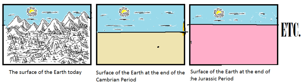
They also keep harping on this whole "razor sharp" contact lines between the layers, as if it was possible for it to be some other way, or something. Doesn't make any sense. You have obviously not been involved in discussions of these things or you'd know the context in which that is said. The point is that mainstream Geology says that the layers represent time periods, (Cambrian, Devonian, Permian, Jurassic, etc) or groups of layers do, and they will point to minuscule amounts of erosion between some layers to prove it, which is utterly ridiculous if you compare it to erosion as seen on the surface of the earth today. Yet they claim those time periods persisted over millions of years. No, their actual appearance is of sediments laid down in water one on top of another, and sometimes they have those extremely razor tight contacts. That is not what you'd get from a surface that had been on the the surface of the Earth for lmillions of years, or even ten or one, or a month. That is evidence for the Flood, not for the Geological Time Scale. Edited by Faith, : No reason given. Edited by Faith, : No reason given. Edited by Faith, : No reason given.
|
|||||||||||||||||||||||||
|
|
Do Nothing Button
Copyright 2001-2023 by EvC Forum, All Rights Reserved
![]() ™ Version 4.2
™ Version 4.2
Innovative software from Qwixotic © 2024